Roja river route download for mobile devices (android/iphone)
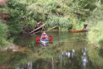
Roja (Viekste in its upper course and Ābeļupe in its middle course) is a river in the Northern Kurzeme, Talsi and Roja Municipalities. The total length of Roja is 78 km, river fall is 52 m. It flows into the Gulf of Riga near Roja. The largest villages located on the riverside are Rude and Roja. Roja is suitable for canoeing when the water level is slightly elevated. In very dry summers you may need to get off the canoe at riffles and take the shallow water nearby. Canoeing along the river Roja can be a nice alternative when rest on the seaside starts to bore you, or the sun hid behind a cloud. Roja will make pleasant surprises to experienced canoers. The preferred route is from Rude to Roja. The most comfortable boarding is at the so-called Sili Complex located near the third bridge [A] from the centre of Rude. Starting from the bridge in the centre of Rude you should remember about the shallow fords located downstream, as their sharp stones may damage your canoe. There are resting areas in several places along the route where you can conveniently get off the canoe and have a picnic. Most popular routes are: Rude - Roja - 13 km Žocene - Roja - 9 km
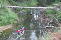
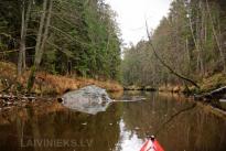
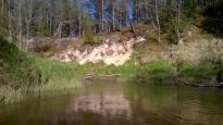
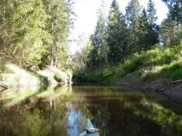
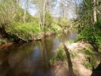
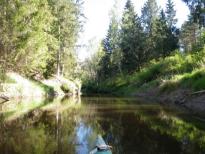
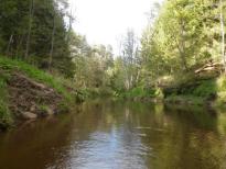
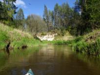
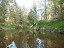
The river flows through the treated fields for the first 3km. It does not cause any issues, as the river shores are about 4m high and are overgrown with alder and bird cherries, and the river bottom is full with rocks. In early summer you will have to share the river with ducklings, please do not scare them or do not touch them - they have not yet learned how to hide and their mum has not abandoned them. The most beautiful section of Roja starts after 6.4 km. The river begins to flow through a conifer forest, and the bank sometimes rises up to 9m. The first sand dunes appear. Alder roots have intertwined forming "mangroves". There are bull calf-sized boulders in the river flow. If you decided to take a swim there, do check the river bed before you jump into the water. Snag and stones are not uncommon here. The fastest current ends at the 8 km of the route where the river begins to flow along the Gulf of Riga and becomes increasingly wider and slower. Over the last 5km to the sea the slope of the river Roja is only half a meter, so canoers will have to row more actively. There are pronounced curves4km before the route end, and Roja slowly flows through a pine forest. The easiest way to get off is before the bridge (c), and there are well-designed places for coming ashore on both banks of the river.
Upe plūst pa skujkoku mežu, krastu kraujas vietām paceļas 9m augstumā, parādās smilšu kāpas. Vietām melnalkšņu saknes savijušas „mangrovju audzēs”. Upes plūdumā dižojas vērsēna izmēra akmeņi. Ja šajā posmā izdomājat peldēties, tad pirms straujas ielekšanas ūdenī noteikti pārbaudiet upes gultni. Siekstas un akmeņi te nav retums. Tuvojoties Rojai un jūrai, beidzas straujākais tecējums, te upe sāk tecēt paralēli Rīgas jūras līcim un tā kļūst arvien platāka un lēnāka. Pēdējos 5km līdz jūrai Rojas kritums ir vien pusmetrs, laivotājiem jārēķinās ar aktīvāku airēšanos. 4km pirms maršruta finiša beidzas izteikti līkumi un Roja rāmi plūst caur priežu mežu. Visērtāk izkāpt pirms tilta (C), abos upes krastos ir labiekārtotas izkāpšanas vietas
 Vētras
 Rojupe
 Sili complex
 Dzintarkrasts
 Žocene
 Resting area
 Resting area
 Roja spring
 Roja river outdoor trail
 Rope track on tree tops
 St Andrew the Apostle Roman Catholic Church
 Roja
Roja
 Meal in a fishermen farmstead
 Small canoe berth
 Boat pier
 Mare
Mare
 Souvenir and craftsmen's products selling point
 Ķipītis
 Roja Marine Fisheries Museum
 Re, paradīze
 Guest house
 Priežkalni
 Štīmers
 SPURA
SPURA
