Rinda and Irbe rivers route download for mobile devices (android/iphone)
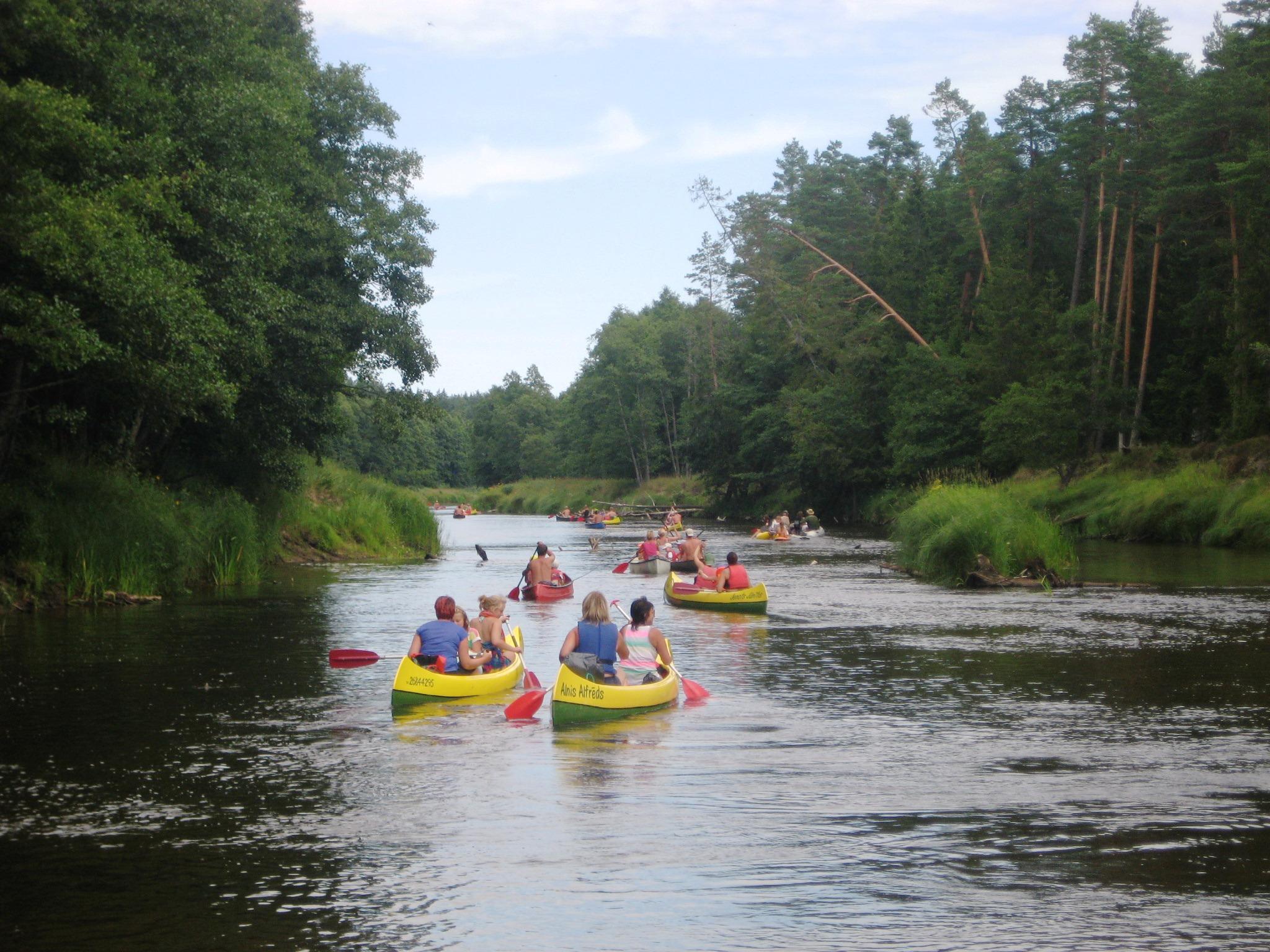
Irbe river is one of the most popular river for canoeing in Latvia.
When starting the route in Rinda village (B), the first 5 km are the lower of the Rinda river - a good flow, black alder avenues and tunnels, sudden and often curves. After the junction with the Stende River it becomes the Irbe. It becomes wider. The shores become higher but the black alders still grow along the water braiding their branches. The Irbe river has no spiteful wish to make fast and loop curves. It flows much loftier. Shrubs and meadows are replaced by the pine forest.
After 4.1km flow the bases (C) of the Lāži bridge and the remaining constructions show up. This is a good landmark, if you want to go to the International radio astronomy center. Climb on the left shore and go 500m along the forest. When reaching the crossroads you will see the giant radio telescope over the trees turned to the silent universe.
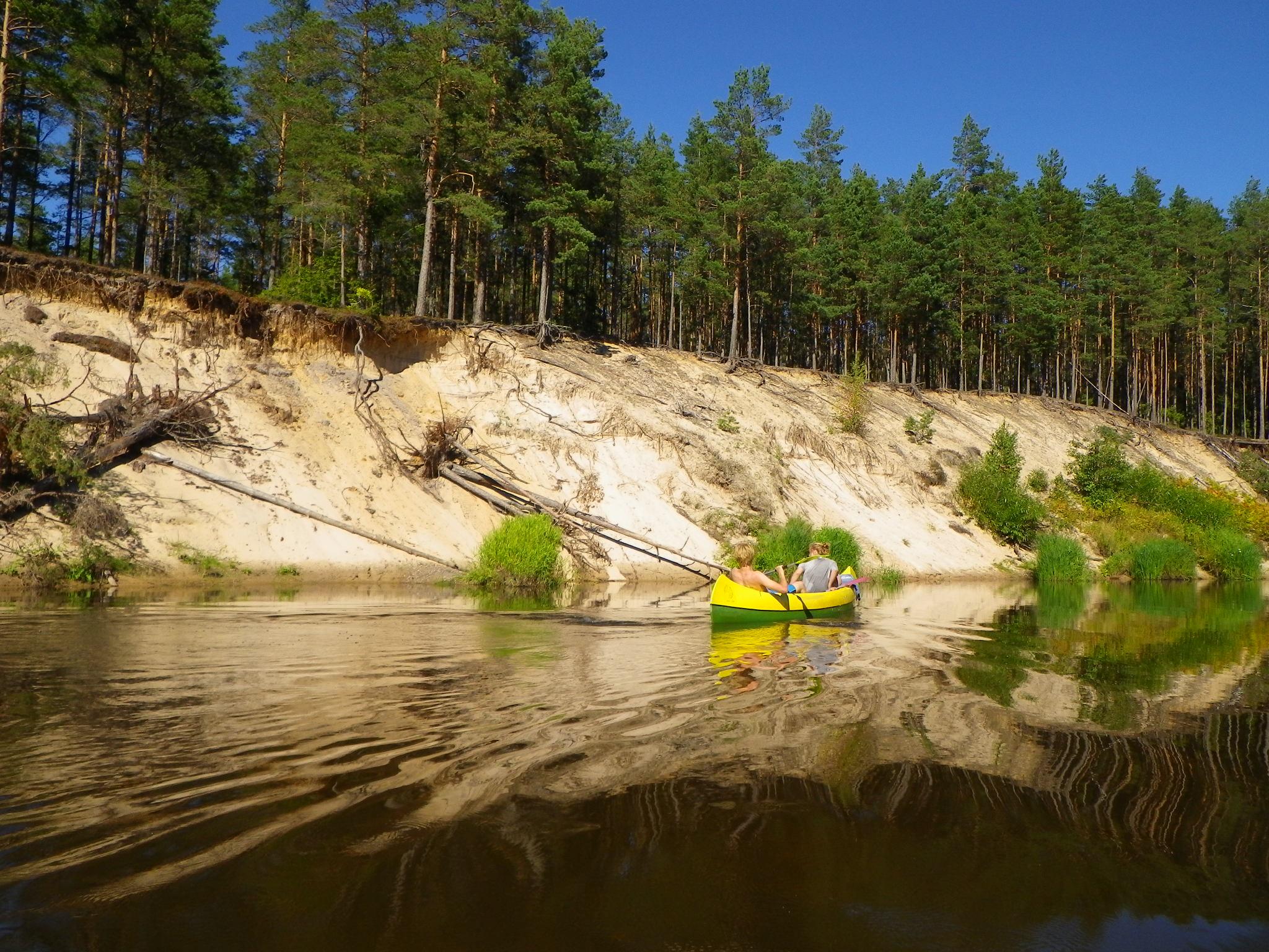
Behind the Lāži bridge (C) the Irbe river flow becomes parallel to the sea. In general, the next 20 km are quite the same. The right shore is more swampy and lower but on the outsides of the left shore curves there are beautiful sand hills. Small islands show up occasionally. The flow is steady but not slow. There is a big island overgrown by trees laying 25km from the beginning of the Irbe river. The sand hill stretch ends here. There are 3.3km left to the Lielirbe (E) - Ventspils - Kolka highway bridge. Many paddlers end their trip at the Lielirbe (E) bridge but it is a very silly thing to do! It would be the same as to go to Sigulda and fill the fuel just for a half way. You must oar to the sea!
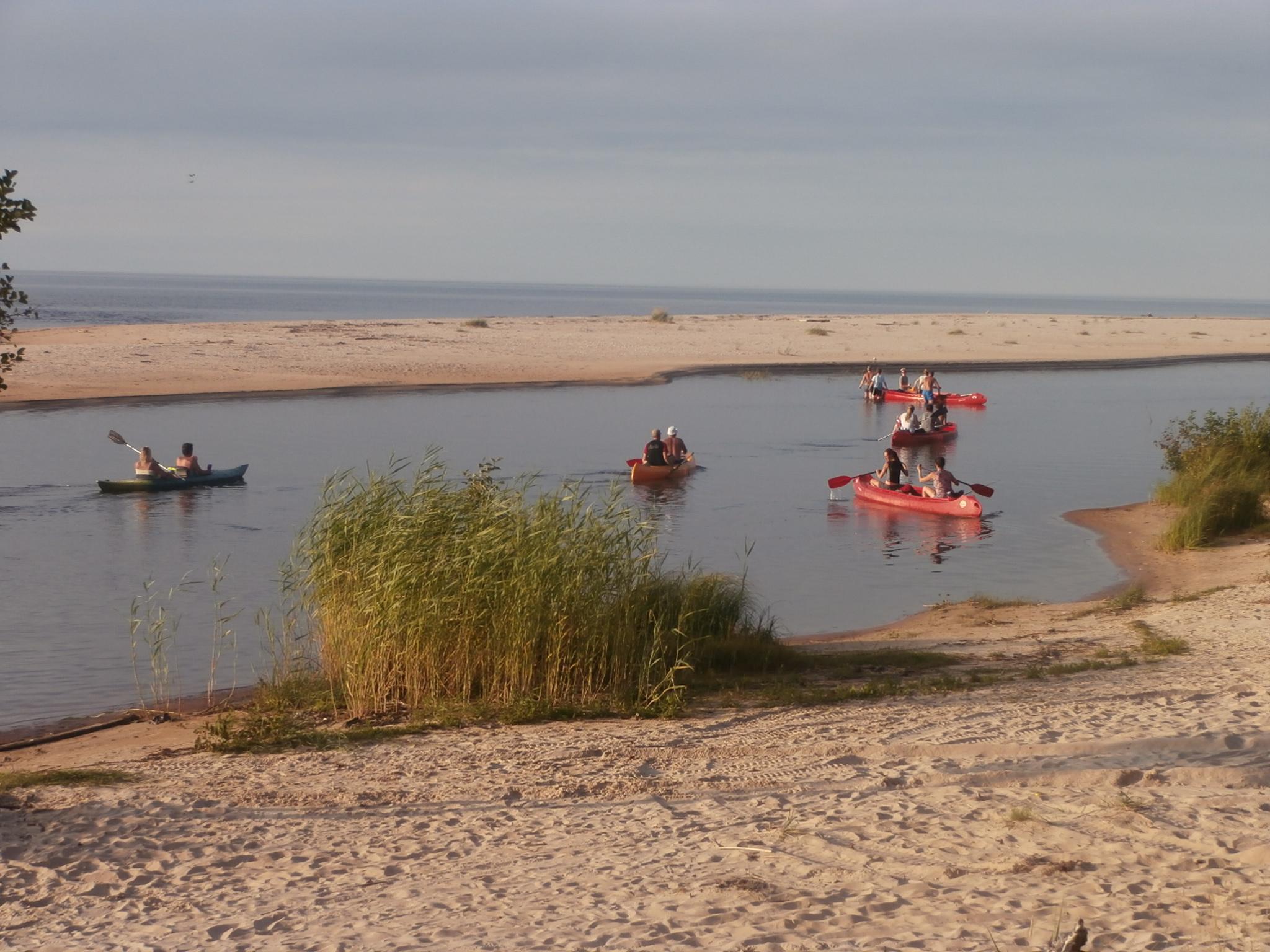
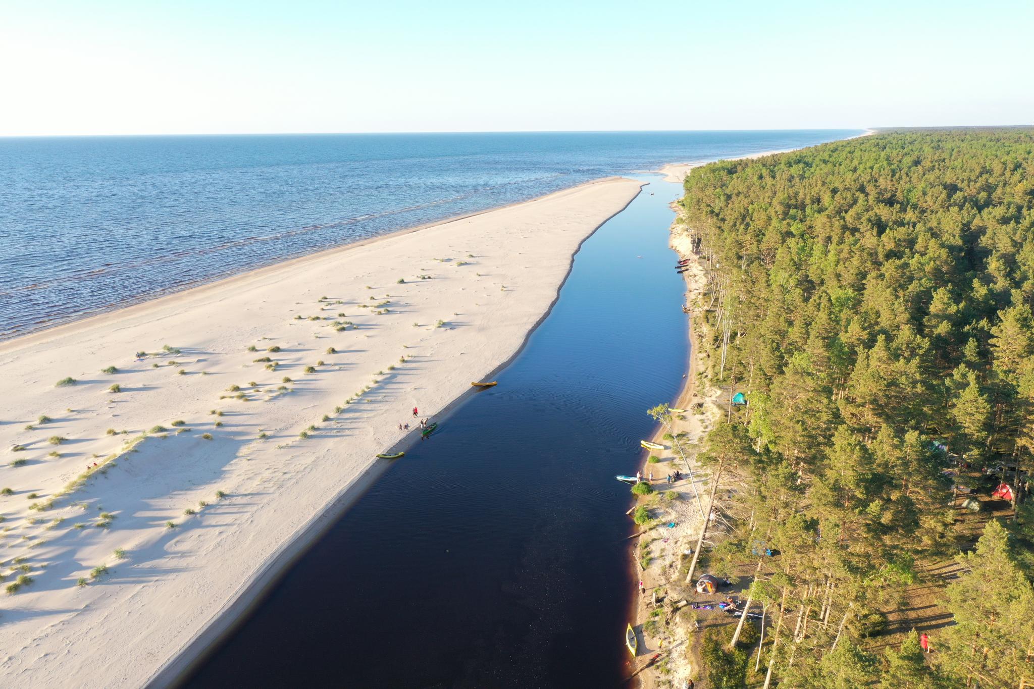
The last 5.8km stretch to the sea is with a slow flow. The river is wide and mostly shallow - there are rare places with a depth “over the head”. The shores are low and swampy. Some houses appear occasionally. There is a wire rope bridge at half-way to the sea, above the bases of the former bridge of the narrow gauge railroad. It is a good place for taking pictures of your group from the above. There is a wide State forest resting area on the right shore where the Irbe river flows into the sea. It is a good place for car parking. Here the most active paddlers get in the sea kayaks to continue the trip along the sea coast to Mazirbe (11km) or Kolka (30km).
Along the river there are landmarks created - numbers from 00 - 6 painted on the trees with bright colours helping to see the passed and remaining distance and to plan an evacuation if necessary.
Most typical 2-day route.
This is nne of the longest water tourism routes in Kurzeme. It takes approximately 5-6 days to canoe - from the Usma lake till the Baltic sea - by the Engure river, Puze lake, Rinda and Irbe rivers until the sea – 95 km.
Usma lake territory, where the Engure river flows out from, is the Moricsala nature reserve (Morics island), where being at and paddling is only allowed with the permission of Kurzeme regional administration of the Nature protection institution. Contacts: + 371 63286000; kurzeme@daba.gov.lv
Please, see the route information here:
http://www.upesoga.lv/lv/marsruti/river/27/route/10
http://www.upesoga.lv/lv/marsruti/river/36/route/722
http://www.upesoga.lv/lv/marsruti/river/37/route/402
 Krastiņi
 Resting area
 Lutheran church and pastor’s manor of Rinda
Rinda Lutheran church
Rinda School
Resting area
Lutheran church and pastor’s manor of Rinda
Rinda Lutheran church
Rinda School
Resting area
 Pedestrian bridge
Resting area near former Lāži bridge
Pedestrian bridge
Resting area near former Lāži bridge
 former Lāži bridge
Ventspils radioastronomy centre
Resting place "Olmaņu meži" (Olman forests)
Landmark - 00 point
Landmark - 1
Landmark - 2
Landmark - 3
Landmark - 4
Resting place P2
Landmark - 5
Landmark - 6
Rojnieki - P3
Laivu noma un atpūta pie Irbes upes "Airē pats"
Irbe camping
Hanging pedestrian bridge
Resting area near the sea
former Lāži bridge
Ventspils radioastronomy centre
Resting place "Olmaņu meži" (Olman forests)
Landmark - 00 point
Landmark - 1
Landmark - 2
Landmark - 3
Landmark - 4
Resting place P2
Landmark - 5
Landmark - 6
Rojnieki - P3
Laivu noma un atpūta pie Irbes upes "Airē pats"
Irbe camping
Hanging pedestrian bridge
Resting area near the sea
 Meža pasaka (Fairy tale of forest)