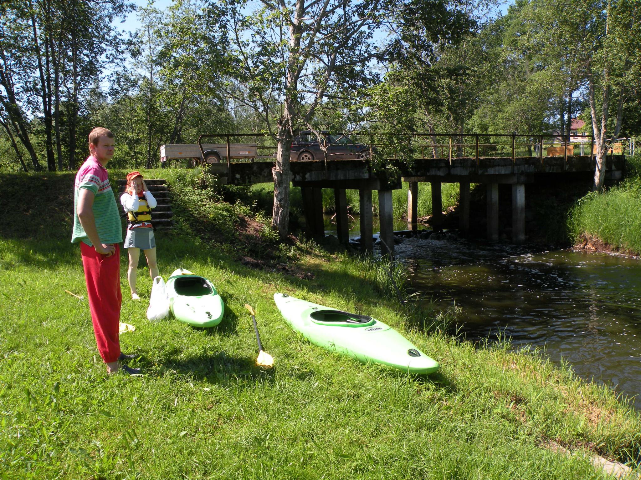
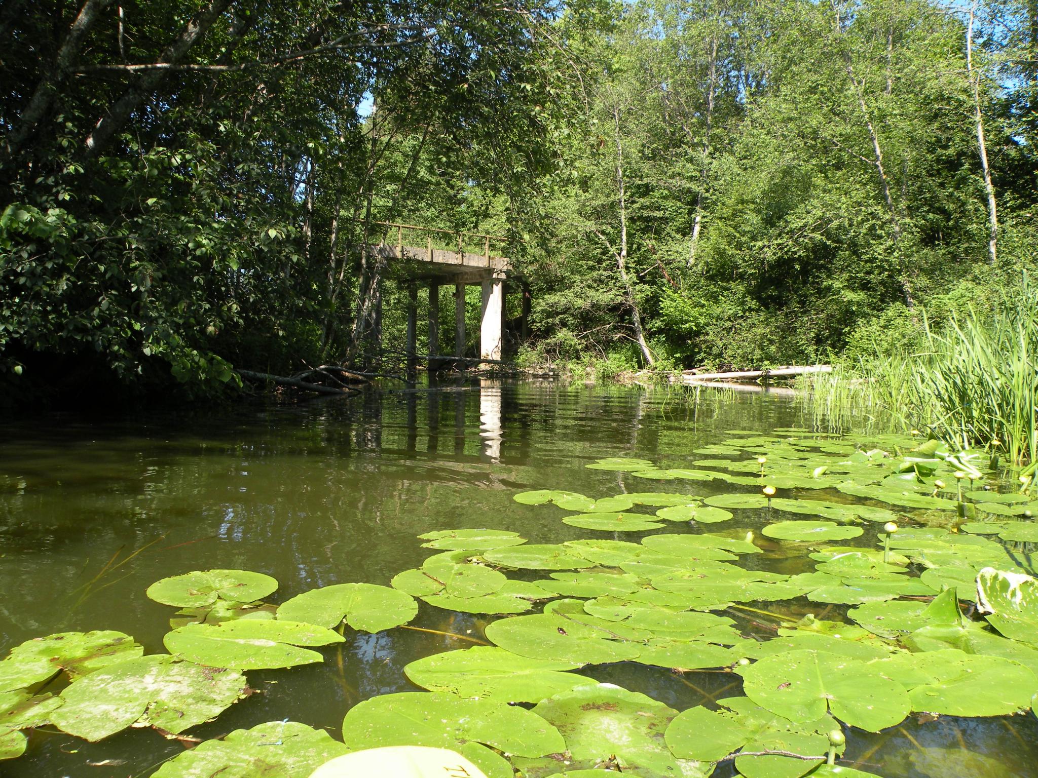
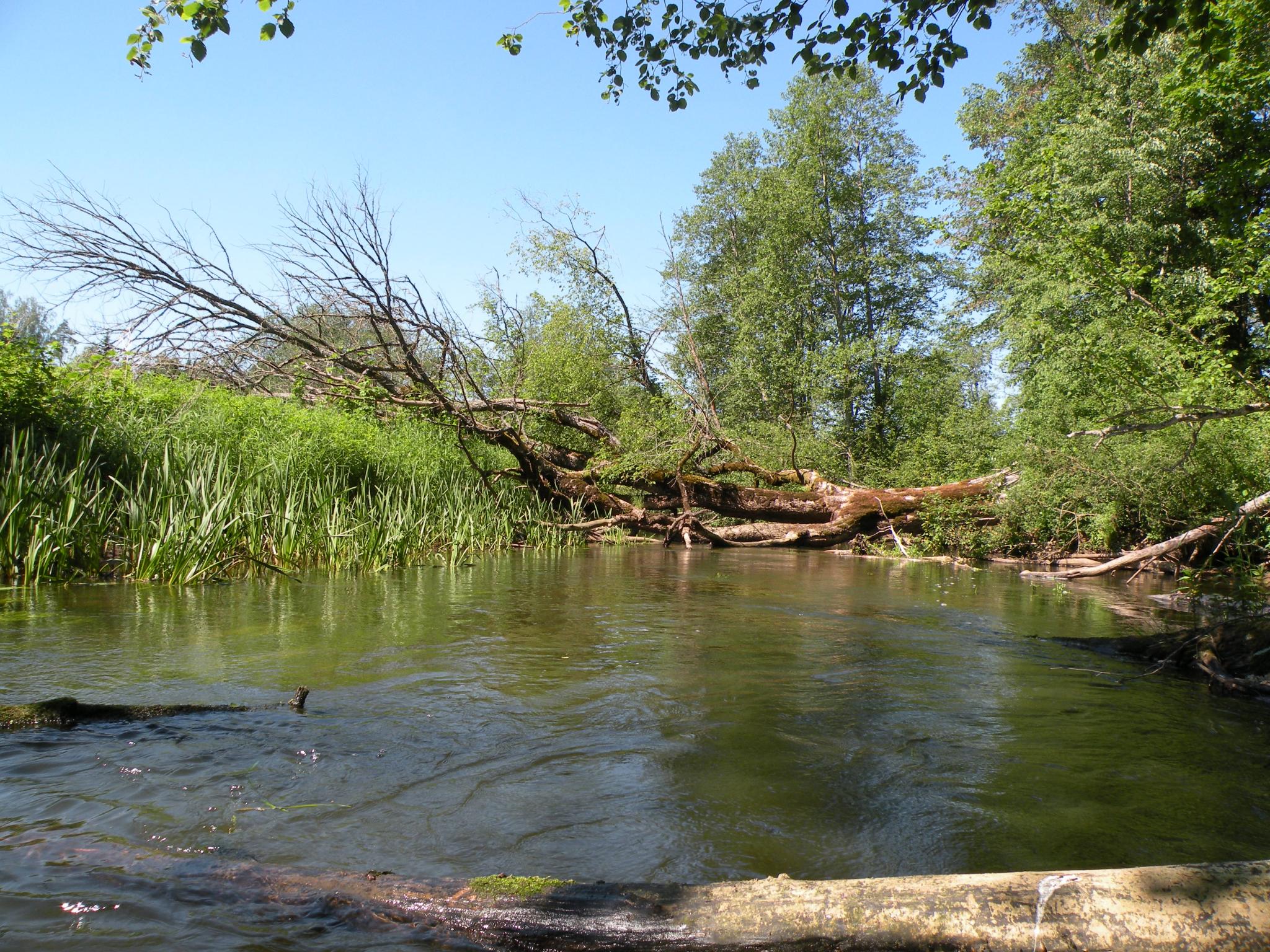
The Svētupe River runs from the north of Dūņezers, and flows into the Gulf of Riga near Svētciems village. The major part of the river basin is located in Metsepole Plain, the upper course in wavy plain of Limbaži, but the bottom course in coast of Vidzeme. The river basein is rich of forests and large swamps (Svētupe, the Great Ērgļi swamp, the Great Rustūži swamp). Svētupe in the upper course reaches flows along the shallow, paludified valley, in the middle course - through a deep valley (near Pale its depth - 10 m). By Pērļupīte River it flows to the north, further up the estuary – to the south. The largest tributaries: on the right bank – Lūdiņupe River (22 km), Šķirstiņa or Pērļupe River (21 km), Sausupe River (11 km), Vedamurga River (8 km). On the left coast – Ārupīte River (16 km), Kulaurga River (5 km). The Svētupe River is internationally defined as the salmon river, where besides salmon and sea trout also many other European significance protected animals - otters, thick shelled river mussel etc. can be found. It is suitable for boating in spring, during high water level period, in autumn, or after long rainy periods. It should be kept in mind that the river has quite a lot of beavers and there are various drift dams what make the boating difficult. It is recommended to boat from Pāle or Lauvas, the boating is possible up to Jaunupe channel through which you can proceed the trip to the Salaca, or try to boat through Svētciems, where the river flows into the Gulf of Riga. After Jaunupe channel that was artificially created in the 17th century Svētupe becomes much narrower because around 2/3 of the river water goes to the Salaca.
The Svētupe River runs from the north of Dūņezers, and flows into the Gulf of Riga near Svētciems village. The major part of the river basin is located in Metsepole Plain, the upper course in wavy plain of Limbaži, but the bottom course in coast of Vidzeme. The river basein is rich of forests and large swamps (Svētupe, the Great Ērgļi swamp, the Great Rustūži swamp). Svētupe in the upper course reaches flows along the shallow, paludified valley, in the middle course - through a deep valley (near Pale its depth - 10 m). By Pērļupīte River it flows to the north, further up the estuary – to the south. The largest tributaries: on the right bank – Lūdiņupe River (22 km), Šķirstiņa or Pērļupe River (21 km), Sausupe River (11 km), Vedamurga River (8 km). On the left coast – Ārupīte River (16 km), Kulaurga River (5 km). The Svētupe River is internationally defined as the salmon river, where besides salmon and sea trout also many other European significance protected animals - otters, thick shelled river mussel etc. can be found. It is suitable for boating in spring, during high water level period, in autumn, or after long rainy periods. It should be kept in mind that the river has quite a lot of beavers and there are various drift dams what make the boating difficult. It is recommended to boat from Pāle or Lauvas, the boating is possible up to Jaunupe channel through which you can proceed the trip to the Salaca, or try to boat through Svētciems, where the river flows into the Gulf of Riga. After Jaunupe channel that was artificially created in the 17th century Svētupe becomes much narrower because around 2/3 of the river water goes to the Salaca.
The Svētupe River runs from the north of Dūņezers, and flows into the Gulf of Riga near Svētciems village. The major part of the river basin is located in Metsepole Plain, the upper course in wavy plain of Limbaži, but the bottom course in coast of Vidzeme. The river basein is rich of forests and large swamps (Svētupe, the Great Ērgļi swamp, the Great Rustūži swamp). Svētupe in the upper course reaches flows along the shallow, paludified valley, in the middle course - through a deep valley (near Pale its depth - 10 m). By Pērļupīte River it flows to the north, further up the estuary – to the south. The largest tributaries: on the right bank – Lūdiņupe River (22 km), Šķirstiņa or Pērļupe River (21 km), Sausupe River (11 km), Vedamurga River (8 km). On the left coast – Ārupīte River (16 km), Kulaurga River (5 km). The Svētupe River is internationally defined as the salmon river, where besides salmon and sea trout also many other European significance protected animals - otters, thick shelled river mussel etc. can be found. It is suitable for boating in spring, during high water level period, in autumn, or after long rainy periods. It should be kept in mind that the river has quite a lot of beavers and there are various drift dams what make the boating difficult. It is recommended to boat from Pāle or Lauvas, the boating is possible up to Jaunupe channel through which you can proceed the trip to the Salaca, or try to boat through Svētciems, where the river flows into the Gulf of Riga. After Jaunupe channel that was artificially created in the 17th century Svētupe becomes much narrower because around 2/3 of the river water goes to the Salaca.
The Svētupe River runs from the north of Dūņezers, and flows into the Gulf of Riga near Svētciems village. The major part of the river basin is located in Metsepole Plain, the upper course in wavy plain of Limbaži, but the bottom course in coast of Vidzeme. The river basein is rich of forests and large swamps (Svētupe, the Great Ērgļi swamp, the Great Rustūži swamp). Svētupe in the upper course reaches flows along the shallow, paludified valley, in the middle course - through a deep valley (near Pale its depth - 10 m). By Pērļupīte River it flows to the north, further up the estuary – to the south. The largest tributaries: on the right bank – Lūdiņupe River (22 km), Šķirstiņa or Pērļupe River (21 km), Sausupe River (11 km), Vedamurga River (8 km). On the left coast – Ārupīte River (16 km), Kulaurga River (5 km). The Svētupe River is internationally defined as the salmon river, where besides salmon and sea trout also many other European significance protected animals - otters, thick shelled river mussel etc. can be found. It is suitable for boating in spring, during high water level period, in autumn, or after long rainy periods. It should be kept in mind that the river has quite a lot of beavers and there are various drift dams what make the boating difficult. It is recommended to boat from Pāle or Lauvas, the boating is possible up to Jaunupe channel through which you can proceed the trip to the Salaca, or try to boat through Svētciems, where the river flows into the Gulf of Riga. After Jaunupe channel that was artificially created in the 17th century Svētupe becomes much narrower because around 2/3 of the river water goes to the Salaca.
The Svētupe River runs from the north of Dūņezers, and flows into the Gulf of Riga near Svētciems village. The major part of the river basin is located in Metsepole Plain, the upper course in wavy plain of Limbaži, but the bottom course in coast of Vidzeme. The river basein is rich of forests and large swamps (Svētupe, the Great Ērgļi swamp, the Great Rustūži swamp). Svētupe in the upper course reaches flows along the shallow, paludified valley, in the middle course - through a deep valley (near Pale its depth - 10 m). By Pērļupīte River it flows to the north, further up the estuary – to the south. The largest tributaries: on the right bank – Lūdiņupe River (22 km), Šķirstiņa or Pērļupe River (21 km), Sausupe River (11 km), Vedamurga River (8 km). On the left coast – Ārupīte River (16 km), Kulaurga River (5 km). The Svētupe River is internationally defined as the salmon river, where besides salmon and sea trout also many other European significance protected animals - otters, thick shelled river mussel etc. can be found. It is suitable for boating in spring, during high water level period, in autumn, or after long rainy periods. It should be kept in mind that the river has quite a lot of beavers and there are various drift dams what make the boating difficult. It is recommended to boat from Pāle or Lauvas, the boating is possible up to Jaunupe channel through which you can proceed the trip to the Salaca, or try to boat through Svētciems, where the river flows into the Gulf of Riga. After Jaunupe channel that was artificially created in the 17th century Svētupe becomes much narrower because around 2/3 of the river water goes to the Salaca.
The Svētupe River runs from the north of Dūņezers, and flows into the Gulf of Riga near Svētciems village. The major part of the river basin is located in Metsepole Plain, the upper course in wavy plain of Limbaži, but the bottom course in coast of Vidzeme. The river basein is rich of forests and large swamps (Svētupe, the Great Ērgļi swamp, the Great Rustūži swamp). Svētupe in the upper course reaches flows along the shallow, paludified valley, in the middle course - through a deep valley (near Pale its depth - 10 m). By Pērļupīte River it flows to the north, further up the estuary – to the south. The largest tributaries: on the right bank – Lūdiņupe River (22 km), Šķirstiņa or Pērļupe River (21 km), Sausupe River (11 km), Vedamurga River (8 km). On the left coast – Ārupīte River (16 km), Kulaurga River (5 km). The Svētupe River is internationally defined as the salmon river, where besides salmon and sea trout also many other European significance protected animals - otters, thick shelled river mussel etc. can be found. It is suitable for boating in spring, during high water level period, in autumn, or after long rainy periods. It should be kept in mind that the river has quite a lot of beavers and there are various drift dams what make the boating difficult. It is recommended to boat from Pāle or Lauvas, the boating is possible up to Jaunupe channel through which you can proceed the trip to the Salaca, or try to boat through Svētciems, where the river flows into the Gulf of Riga. After Jaunupe channel that was artificially created in the 17th century Svētupe becomes much narrower because around 2/3 of the river water goes to the Salaca.
 Izteka no Dūņezera
lkp Lūdiņupe
Tilts
Izteka no Dūņezera
lkp Lūdiņupe
Tilts
 Ungurkalns
lkp Šķirstiņa
Tiltiņš
Zaķu goba
Bijušais šaursliežu dzelzceļa tilts
Ungurkalns
lkp Šķirstiņa
Tiltiņš
Zaķu goba
Bijušais šaursliežu dzelzceļa tilts
 Atpūtas vieta
Sīpolkalna akmens
Atpūtas vieta
Sīpolkalna akmens
 Viesu nams “Smēdes”
Stāvkrasts
Maija grove (May grove)
Tilts pie Pāles
Memorial stone
lk bijušās Pāles dzirnavas
lkp Pērļupīte
lkp Sausupe
Ozolkalniņš stone
kkp no Tumatu dīķa
Tiltiņš
Tilts
Tiltiņš
kkp Arupīte, bijušais dzirnavu aizsprosts
Lielkadagi spring
Sākas smilšakmens atseguma klintis
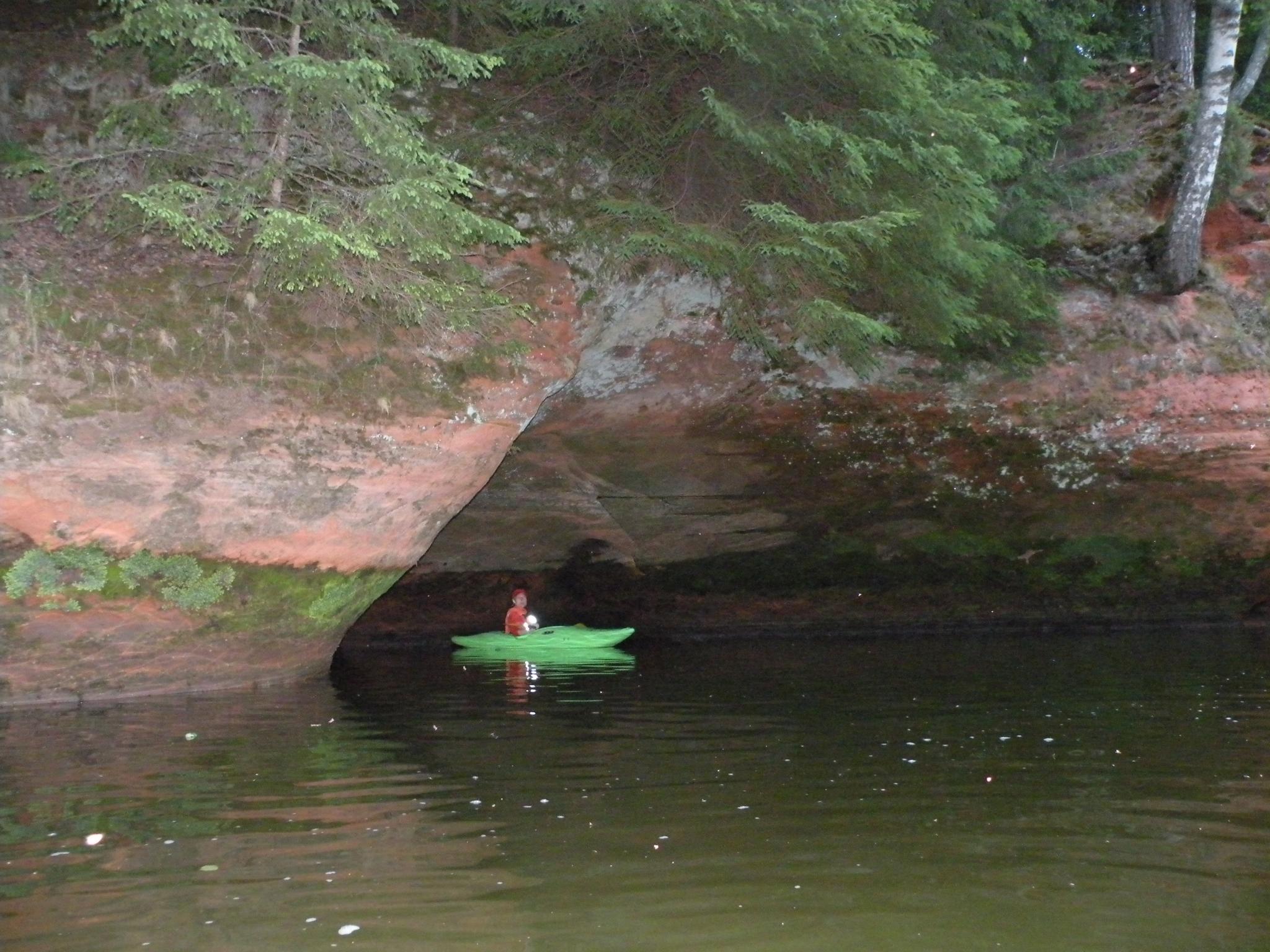
Liv Sacrificial Caves
Drūmā klints
Viesu nams “Svētupes”
Tilts
Akmens upes vidū
lkp Vedamurga
Viesu nams “Kraukļi”
lk Jaunupe
Jaunupes dambis
Tilts (V143)
Tilts
Tiltiņš
Tilts
Svētciema dzirnavu vieta
Tiltiņš
Tilts Svētciemā (A1)
Tiltiņš
Tilts
Viesu nams "Vējavas"
Viesu nams “Rakari”
Tiltiņš
Atpūtas vieta
Tacis
Izteka jūrā
Marķēts veloceliņš Nr. 101
Atpūtas vieta - labiekārtota pludmale
Viesu nams "Kosīši"
Viesu nams “Smēdes”
Stāvkrasts
Maija grove (May grove)
Tilts pie Pāles
Memorial stone
lk bijušās Pāles dzirnavas
lkp Pērļupīte
lkp Sausupe
Ozolkalniņš stone
kkp no Tumatu dīķa
Tiltiņš
Tilts
Tiltiņš
kkp Arupīte, bijušais dzirnavu aizsprosts
Lielkadagi spring
Sākas smilšakmens atseguma klintis
Liv Sacrificial Caves
Drūmā klints
Viesu nams “Svētupes”
Tilts
Akmens upes vidū
lkp Vedamurga
Viesu nams “Kraukļi”
lk Jaunupe
Jaunupes dambis
Tilts (V143)
Tilts
Tiltiņš
Tilts
Svētciema dzirnavu vieta
Tiltiņš
Tilts Svētciemā (A1)
Tiltiņš
Tilts
Viesu nams "Vējavas"
Viesu nams “Rakari”
Tiltiņš
Atpūtas vieta
Tacis
Izteka jūrā
Marķēts veloceliņš Nr. 101
Atpūtas vieta - labiekārtota pludmale
Viesu nams "Kosīši"


Jaunarkādijas, Salacgrīvas pagasts, Limbažu novads
(+371) 29222653
(+371) 26117998


Smilšu iela 37, Salacgrīva, Salacgrīvas nov.
(+371) 29286220

(+371) 26388070


(+371) 29256663

