Route download for mobile devices (android/iphone)
Põltsamaa River is third in length amongst Estonian rivers and also the only one that passes through four counties. It is 135 km long, ~115 km of its length is suitable for water tourism throughout the year, unless there is ice. With River Pede, Pedja and Emajõgi up to Võrtsjärve Visiting Centre, the length of the route comes up to 135 km. The river is fed by groundwater, making it passable even on dry periods. Suitable for boat, canoe and other vehicles from Ao impounded lake.
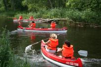
Canoe trips on River Põltsamaa take travelers through protected bog areas where the river meanders lazily and creates multiple old rivers; and the scenic downtown area of Põltsamaa where it rushes over rapids. There are karstic features in the area, lots of fossil-rich limestone deposits.
Be careful about the trees that might have been fallen into the water!
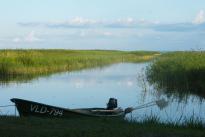
This route of River Põltsamaa is rather calm, a few spots are quick-flowing. First, you can see forest, hayfields and bog area (Endla Nature Reserve) on the shore; later, forest varies with hayfields and farmlands. There is almost no settlement on the riverbanks.
The downfall is a bit higher in this part of River Põltsamaa. Most of the time, river is shallow, stony and alvar. You can see settlements on the riverbanks.
Põltsamaa River is third in length amongst Estonian rivers and also the only one that passes through four counties. It is 135 km long, ~115 km of its length is suitable for water tourism throughout the year, unless there is ice. With River Pede, Pedja and Emajõgi up to Võrtsjärve Visiting Centre, the length of the route comes up to 135 km. The river is fed by groundwater, making it passable even on dry periods. Suitable for boat, canoe and other vehicles from Ao impounded lake.
Canoe trips on River Põltsamaa take travelers through protected bog areas where the river meanders lazily and creates multiple old rivers; and the scenic downtown area of Põltsamaa where it rushes over rapids. There are karstic features in the area, lots of fossil-rich limestone deposits.
Be careful about the trees that might have been fallen into the water!
This route of River Põltsamaa is rather calm, a few spots are quick-flowing. First, you can see forest, hayfields and bog area (Endla Nature Reserve) on the shore; later, forest varies with hayfields and farmlands. There is almost no settlement on the riverbanks.
In this part of River Põltsamaa, flow is variating. Route goes through Lake Kamari. After passing the lake, the right riverbank is covered with settlements and farmlands, left bank is mostly covered by Alam-Pedja Nature Reserve.
In this route of River Põltsamaa, river is a little calmer. The shores are covered with forest, Alam-Pedja Nature Reserve can be viewed on the left shore. In the end of the route runs Suur-Emajõgi - you can usually pass it by going upstream, but depending on the water level (during flood), you may go downstream.
 Rutikvere manor
 Jäägi Farm
 Pajusi manor
 Põltsamaa rose garden
 Põltsamaa castle
 Pihla Holiday House
 Lake Kamari recreation area
(+372) 511 9117
(+372) 514 5430

