Užava river route download for mobile devices (android/iphone)
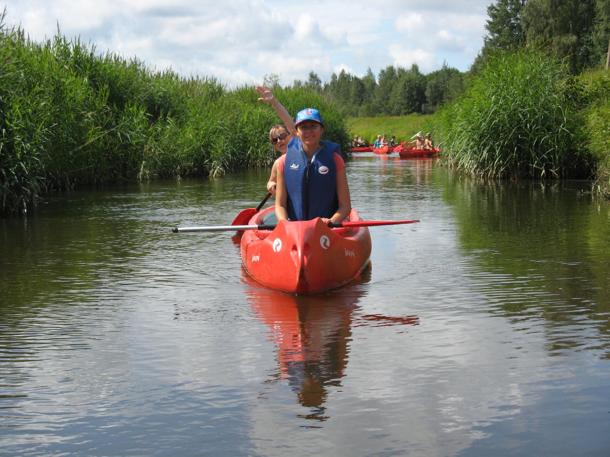
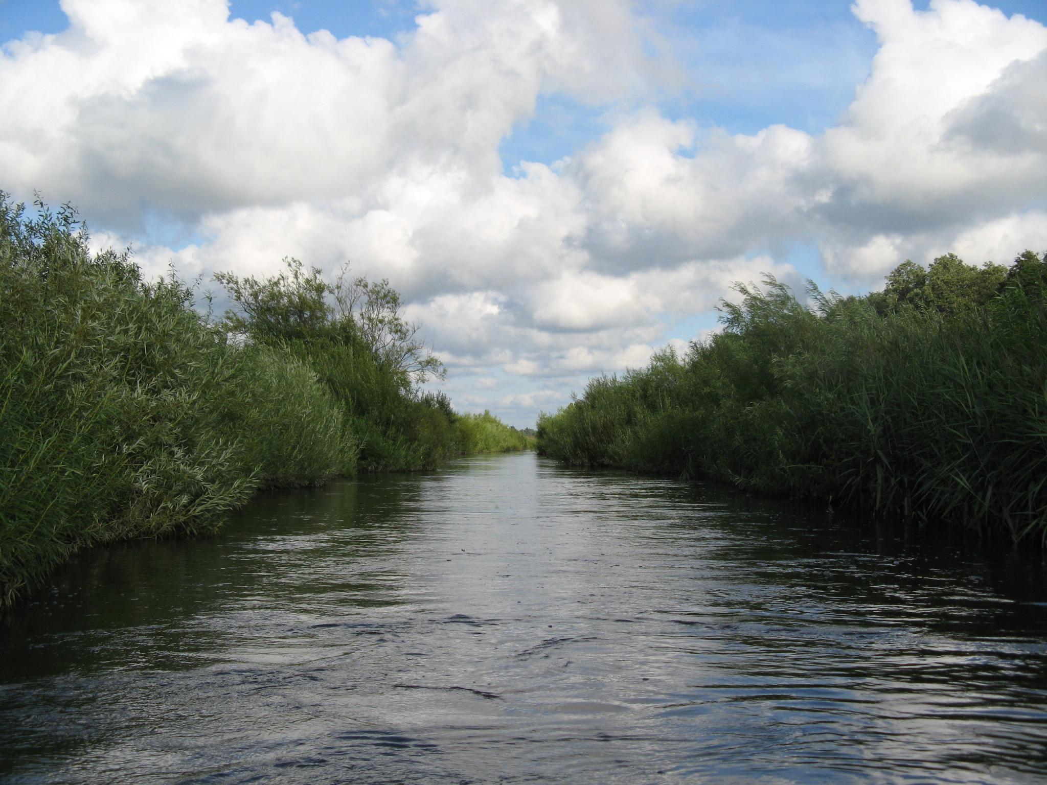
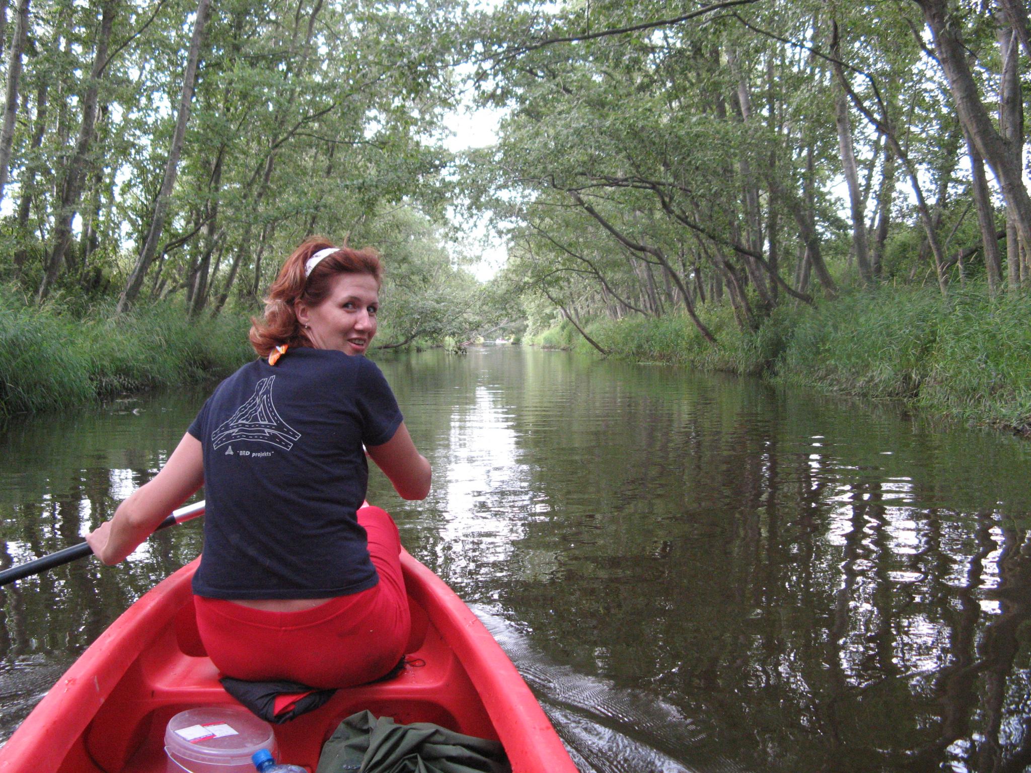
Užava (also called Dižupe, Zirgmežupe; river Mazkaiba or Mālupe in its upper course; Bumbuļupe in its mid-course) flows into the Baltic sea below Užava village. It starts from draining ditches between Gudenieki and Basi manor. It flows through Piemare (Littorina Sea bed) and Ventava Plains. The most of the course, except for the section between Tērande and Sise, has been regulated, the river bed was straightened during the first Republic of Latvia and in Soviet time. Out of 67 km, 31 km are suitable for canoeing - from the right bank of the confluence Vanka to the sea. In summer the water in the river is clear, and it has rich underwater flora and fauna. The course to Užava village is good. The river bottom is sanded, there is rough gravel and stones in some places. The river bottom is covered by loam and grey sand closer to the sea. The shores are sandy or clayey, with signs of severe erosion, 1 - 2m high and overgrown with deciduous trees. There are mostly willow shrubs on the shores in the drained sections You can travel on the river Užava by canoe and kayak. Previous paddling experience is mandatory under conditions of elevated water level! Well-designed camp sites can only be found at the beginning of the route – in Stradži and in a number of places at the end of the route – in Užava village and just before the sea, so it is recommended to complete canoeing along Užava in one day by adopting a fast and sporty pace. When canoeing, you will see kilometre point to the sea on bridges and other landmarks! Most popular routes: Stradži - jūra - 31 km - 1-2 dienas Sises tilts - jūra - 19 km - 1 diena
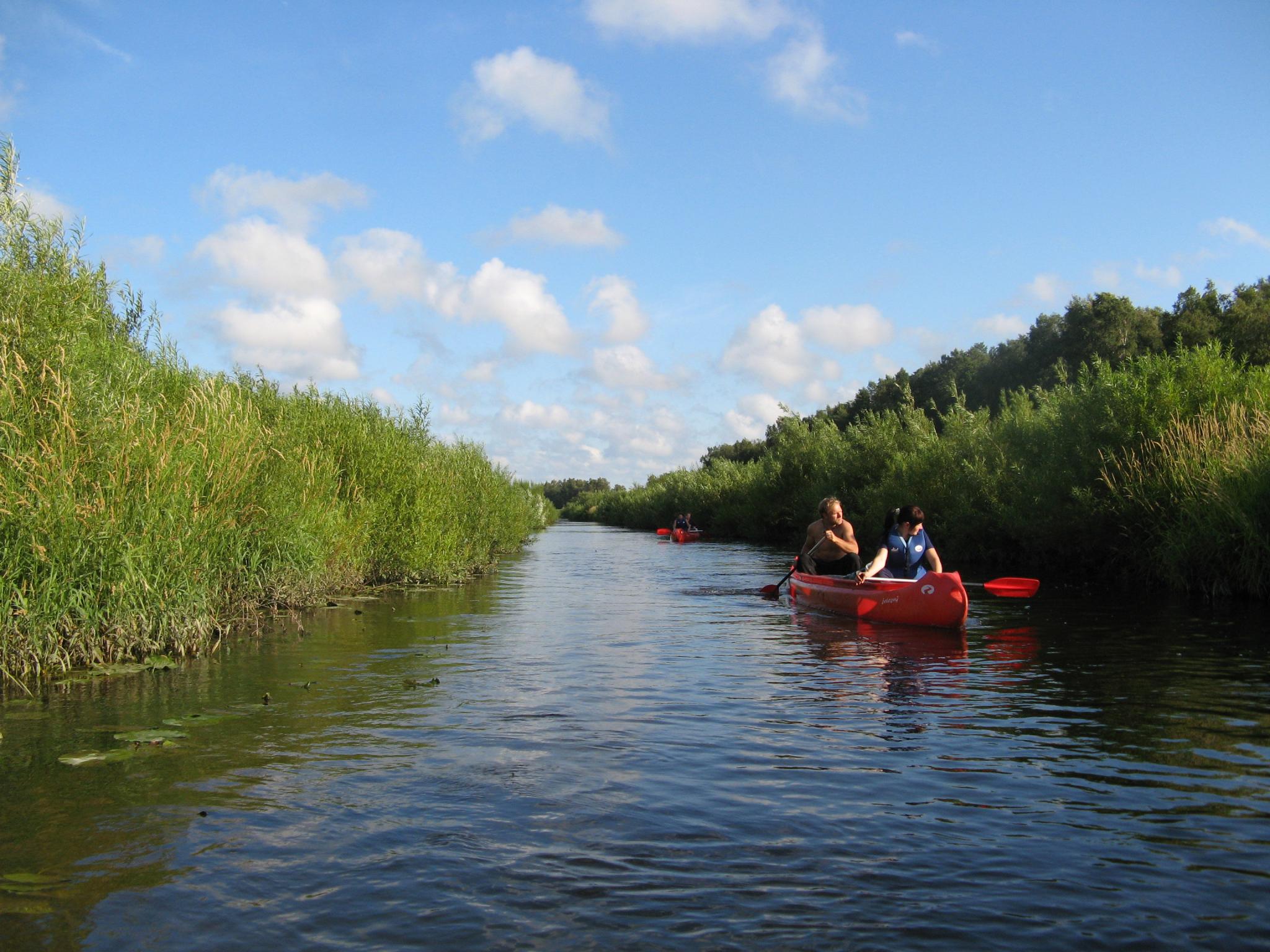
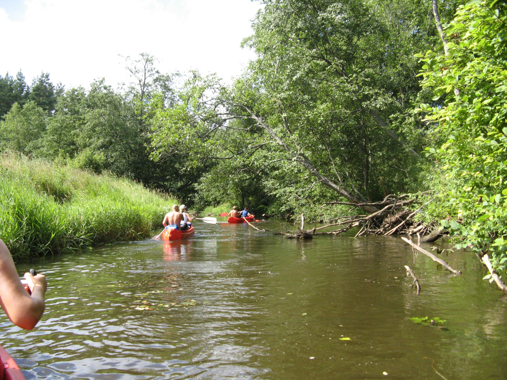
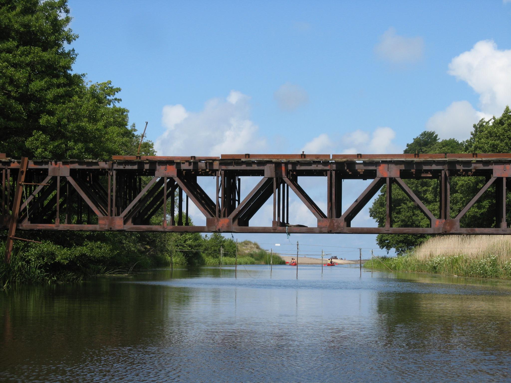
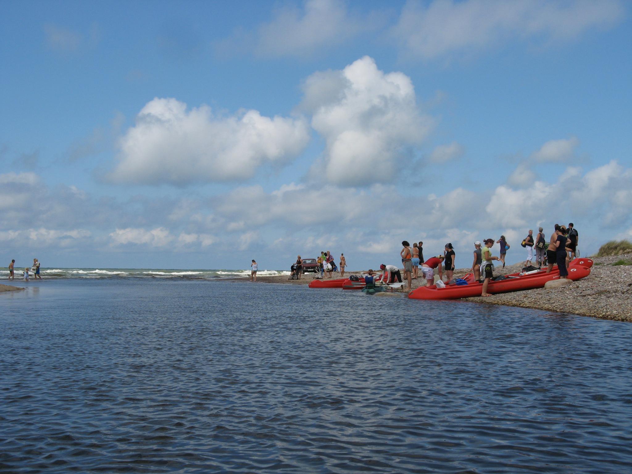
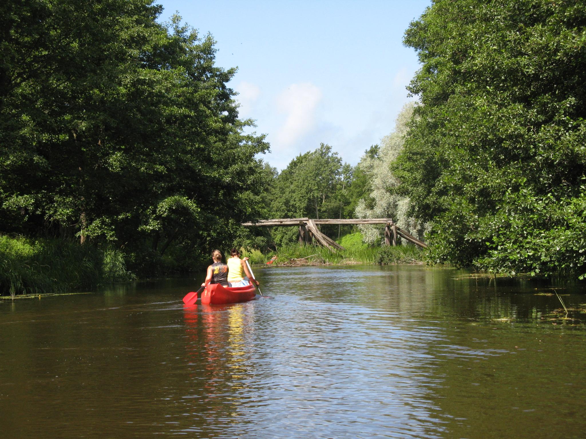
The section from Stradži (A) to Tērande (B) runs slowly through pastures and undergrowth. The scenery of the shore is monotonous, and this is a good time to get more comfortable in the canoe. The most beautiful stage of Užava starts in Tērande (B) and continues until Sise (C). The river is quite snaky, the trees growing on its shores often intertwine their branches above the stream. There are some swifts and large stones. Before Sise the river considerably narrows and its course gets only around 2m wide, its speed increases. After a typical bottleneck there are ruins of an old mill dam, and the riverbed is covered with heavy stones. This is the only place on Užava where inexperienced paddlers happen to turn their canoe over or draw in water at a higher water level. There is nothing dangerous here at a low level. Sise reinforced concrete bridge (C) is the end point for one-day canoeing. After the Sise bridge (C) the river straightens rapidly, and the drainage consequences are clearly visible. Absolutely straight 5km long sections are rich in fish and the surrounding fauna. There may be trees fallen across the river and drifts, but the most of them can be circumnavigated or crossed over. The course almost stops before Užava village and the river is very slow during the last 3km to the sea, you can hear the sea roaring afar. The river flows along the sea for the last 500m, you can see the dunes and behind them - the beach and the sea. There is a foot bridge across the river right before the sea with hanging fishing tackles and lamprey traps; stay on the right - it is usually free for canoeing. The route ends at the spot where the rivers flow into the sea. There is an easily accessible berth space on the right shore and the Latvian State Forests resting area. Maršruta finišs ir tieši upes ietekā jūrā. Labajā krastā ir ērta piebraukšanas vieta un Latvijas Valsts mežu apmetne.
The section from Stradži (A) to Tērande (B) runs slowly through pastures and undergrowth. The scenery of the shore is monotonous, and this is a good time to get more comfortable in the canoe. The most beautiful stage of Užava starts in Tērande (B) and continues until Sise (C). The river is quite snaky, the trees growing on its shores often intertwine their branches above the stream. There are some swifts and large stones. Before Sise the river considerably narrows and its course gets only around 2m wide, its speed increases. After a typical bottleneck there are ruins of an old mill dam, and the riverbed is covered with heavy stones. This is the only place on Užava where inexperienced paddlers happen to turn their canoe over or draw in water at a higher water level. There is nothing dangerous here at a low level. Sise reinforced concrete bridge (C) is the end point for one-day canoeing.
After the Sise bridge (C) the river straightens rapidly, and the drainage consequences are clearly visible. Absolutely straight 5km long sections are rich in fish and the surrounding fauna. There may be trees fallen across the river and drifts, but the most of them can be circumnavigated or crossed over. The course almost stops before Užava village and the river is very slow during the last 3km to the sea, you can hear the sea roaring afar. The river flows along the sea for the last 500m, you can see the dunes and behind them - the beach and the sea. There is a foot bridge across the river right before the sea with hanging fishing tackles and lamprey traps; stay on the right - it is usually free for canoeing. The route ends at the spot where the rivers flow into the sea. There is an easily accessible berth space on the right shore and the Latvian State Forests resting area.
 Stradži
 Tērande manor
 Pedestrian bridge
Former hay flour miiling plant
Pedestrian bridge
Former hay flour miiling plant
 Landmark
 Auseklītis
 Užava Elementary School Youth Hostel
Užava Lutheran Church
Užava Elementary School Youth Hostel
Užava Lutheran Church
 Tarzeri
Upmalnieki
Saliņas
Krastkalni resting place
Pedestrian bridge
Resting area of Latvian State Forests
Užava brewery
Užava lighthouse
Resting area of Latvian State Forests
Tarzeri
Upmalnieki
Saliņas
Krastkalni resting place
Pedestrian bridge
Resting area of Latvian State Forests
Užava brewery
Užava lighthouse
Resting area of Latvian State Forests