


Gauja river route download for mobile devices (android/iphone)
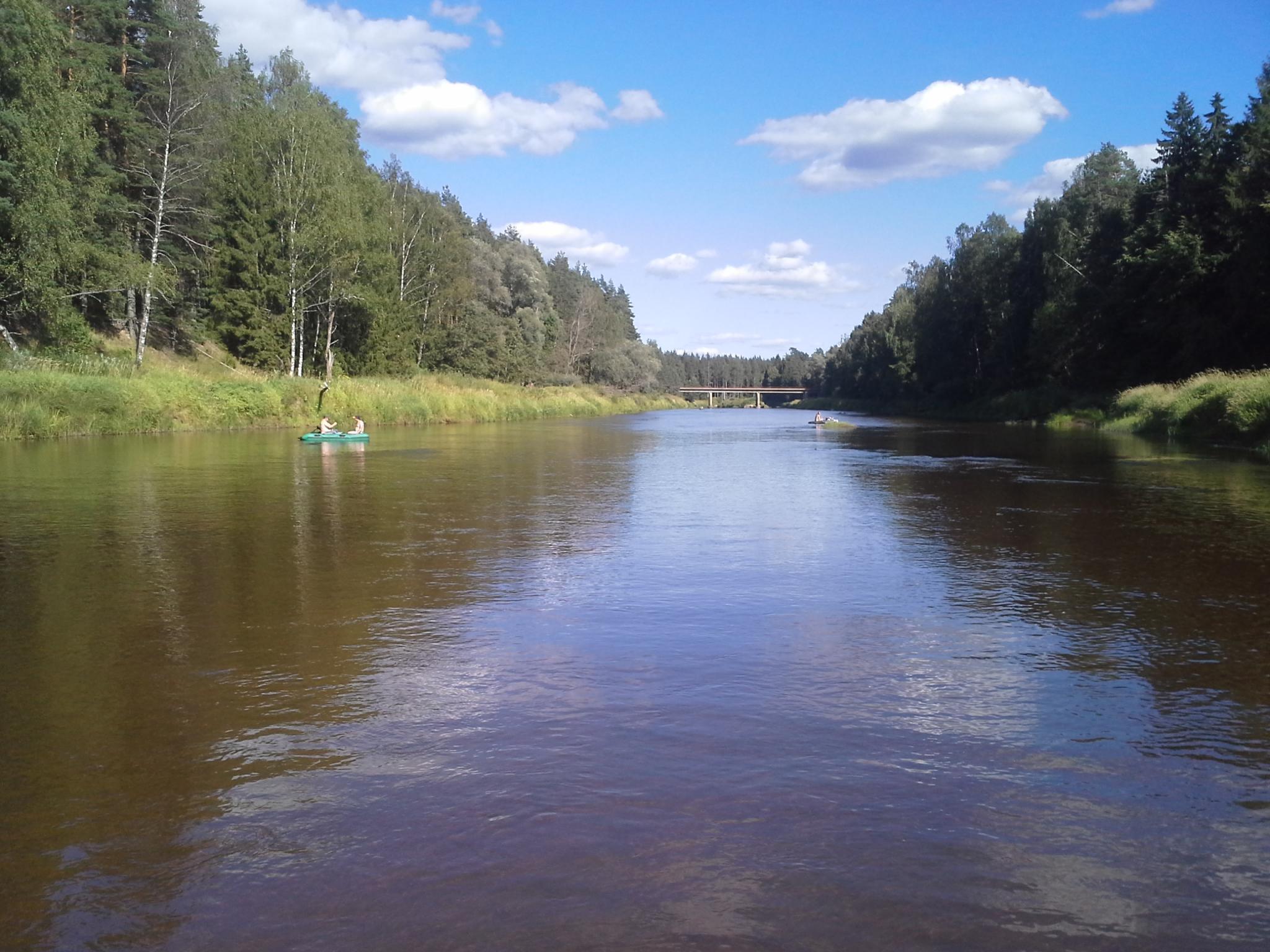
The Gauja is the most popular paddling river in Latvia, what takes a capricious circle through Vidzeme, collecting 440 winding kilometres in total, while the distance in the air line between the outlet and estuary shows only 90 km.
In terms of water tourism the Gauja conditionally can be divided into 3 sections: section of HPPs cascade, in Popular section and in Upper course section.
Section of HPPs cascade is popular among paddlers - “collectors of different landscapes”, as well as here are cosy one and two-day routs with local rental boat points. In further 115 km there is a series of small lakes, overfalls and flooded dams in the Gauja.
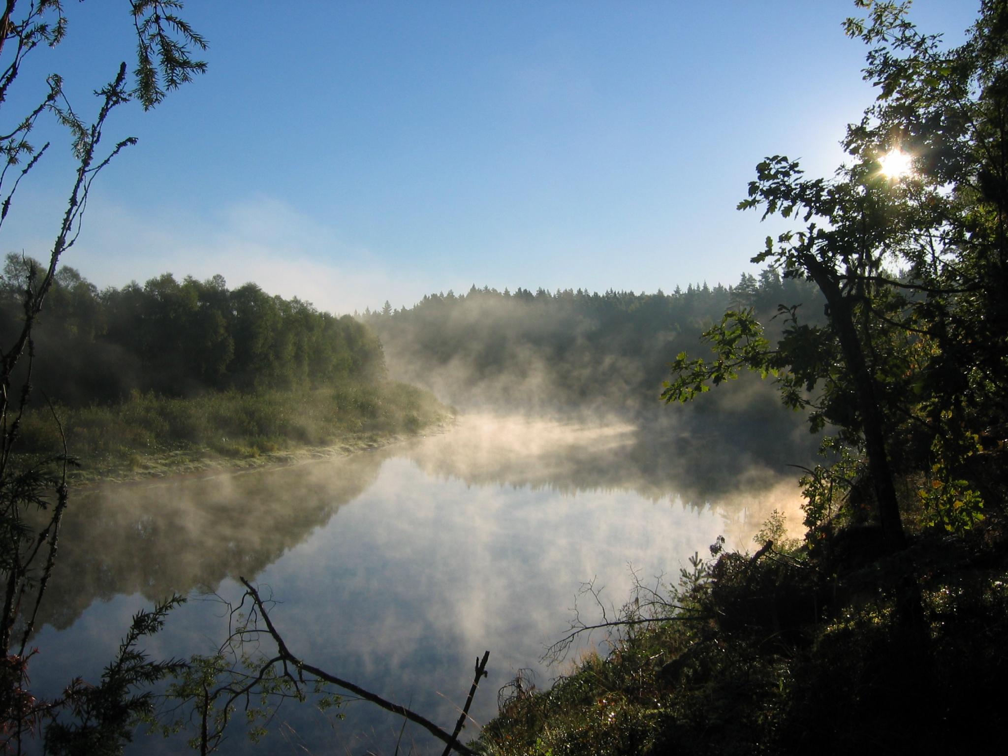
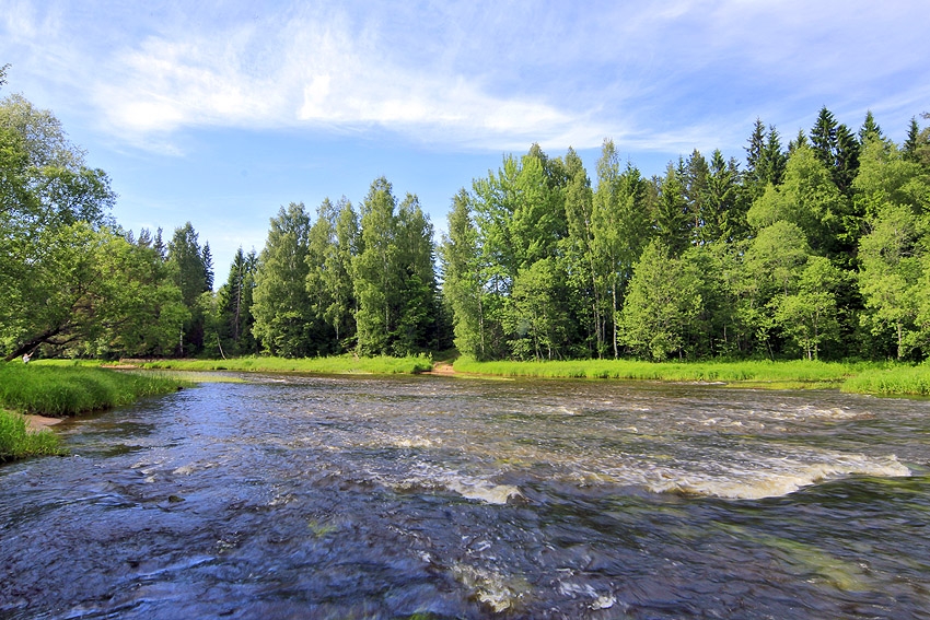
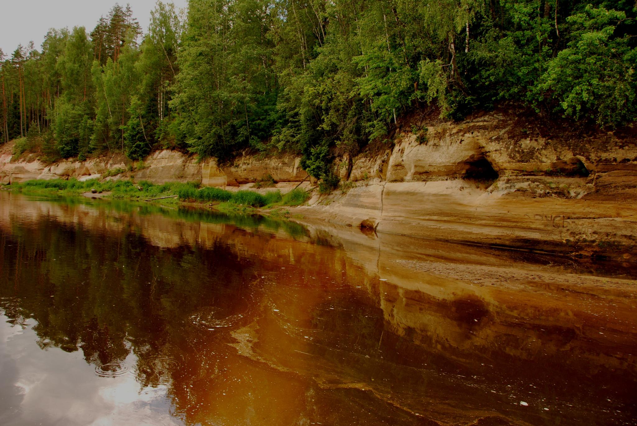
Behind Lejasciems the Popular section of the Gauja is starting. Up to Aņņi (Valka - Gaujiena) bridge the Gauja is wide river with a good stream what flows mostly through bushy meadows. Behind Aņņi bridge the river begins to throw sharp bends and here starts 60 km long section up to Strenči what is famous due its sandbanks in internal sides of the bends and steep banks of loose sand, washed out by the river in the outer sides of bends. From Strenči to Valmiera the Gauja flows through populated and wooded area, while from Valmiera begins the most favorite section of the Gauja, which is 82.8 km long and continues up to Sigulda. Here are concentrated all of the most favourite sightseeing objects and cliffs..
Behind Sigulda the tourist flow sharply decreases and there is a feeling that the Gauja here is starting to breathe again. Behind Murjāņi the river flow becomes slower, the fast bends are ending, and the Gauja is full of large islands. At the Gauja estuary in the sea on the right bank there is a good access road and a place where to end the longest paddling route in Latvia.
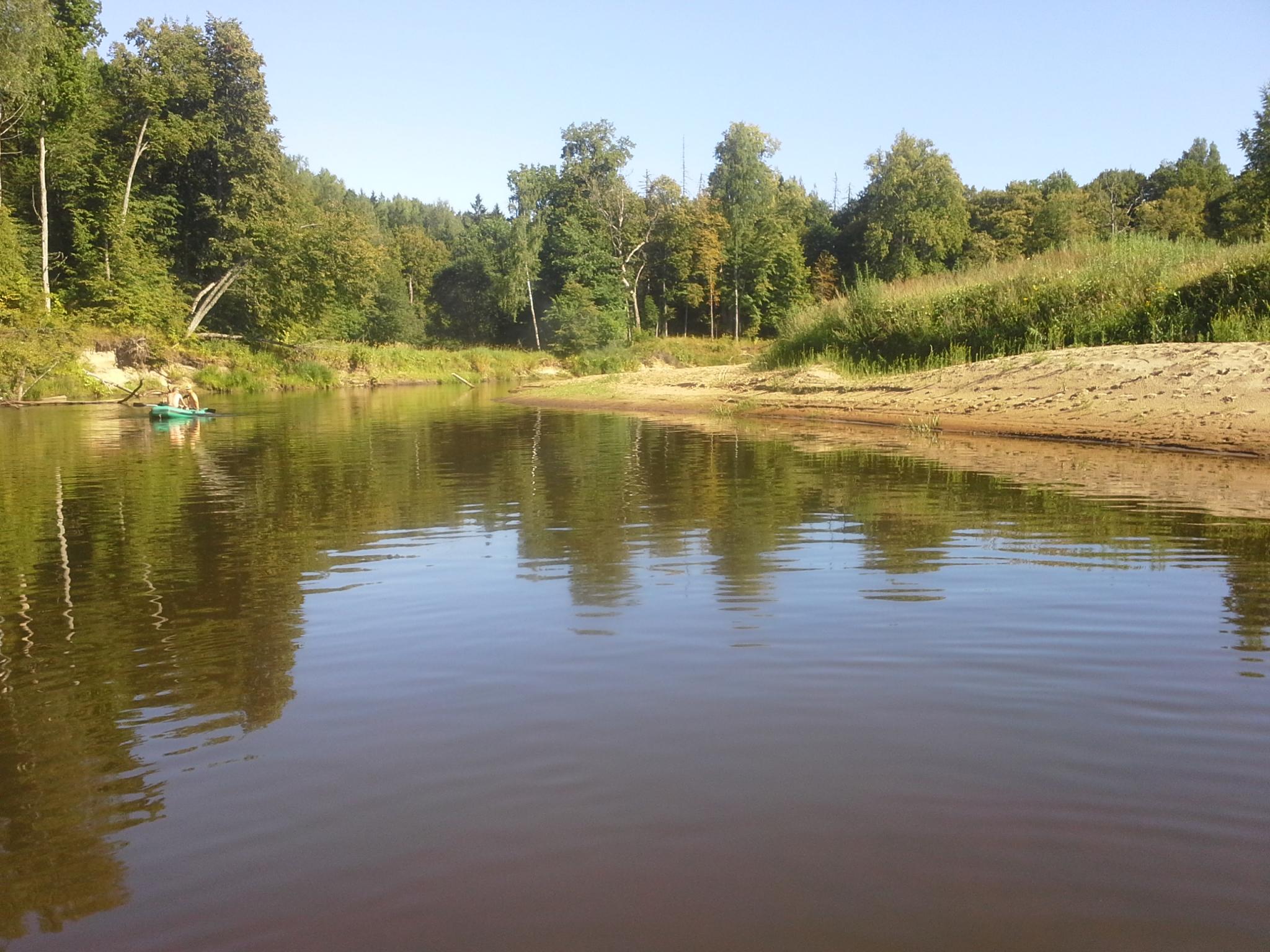
One of the classic paddling routes along the Gauja River. Behind the railway bridge begins exciting river section - Strenči rapids, which continues until Krāčupe estuary. Further the river banks become higher and more picturesque. Behind the Mellupe estuary on the right bank is Sīmanēni Holy Oak, where it is possible to get the strength for further paddling. Closer to Valmiera the river has more sandbanks. The end of the route the in Daliņi is recommended for paddlers who are afraid to go through Kazu rapids in Valmiera, but if you have the skills for getting through rapids and you want to enjoy sharper feelings – surely go futher up to the boat station in Valmiera.
Behind Lejasciems the Gauja is no longer obstructed with HPPs and here can be enjoyed the natural flow of the river with a good stream. Paddlers will be spirited by Sikšņi un Vidaga rapids. Up to Vireši on the banks of the river can be seen dolomite outcrops.
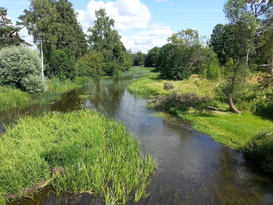
The route begins upstream above Aņņi (P 23) bridge on the left bank of the river. Behind the bridge it is possible to see as oxbows are formed – the Gauja is straightened the riverbed. The river slowly flows through the floodplain meadows and further it winds through the woods, where one bank is washed out higher, the second one is flat with a wide sandbank. Forests are rich in berries and mushrooms. The route ends downstream behind Spicrāmis (P24) bridge on the right bank.
A few hours leisure trip from the comfortably accessible Jāņrāmis settlement up to Cēsis bridge. In the middle of the route are glorious Ēgrļi (Ērģeļu) rocks, where you can easily get out. At the cliffs are installed stairs that lead to get on a viewing platform and to watch the picturesque landscape.
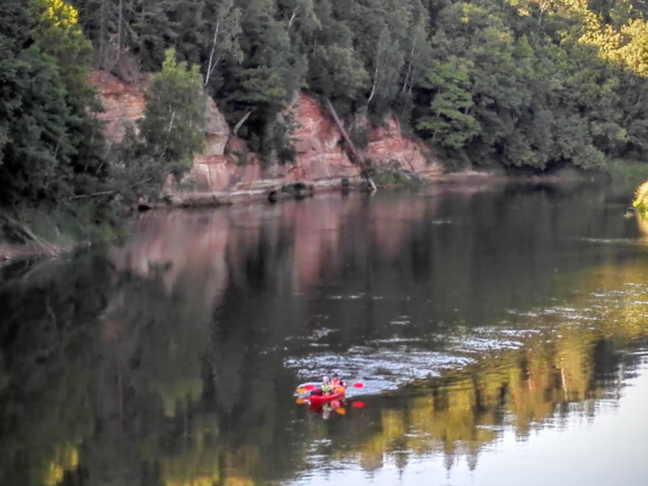
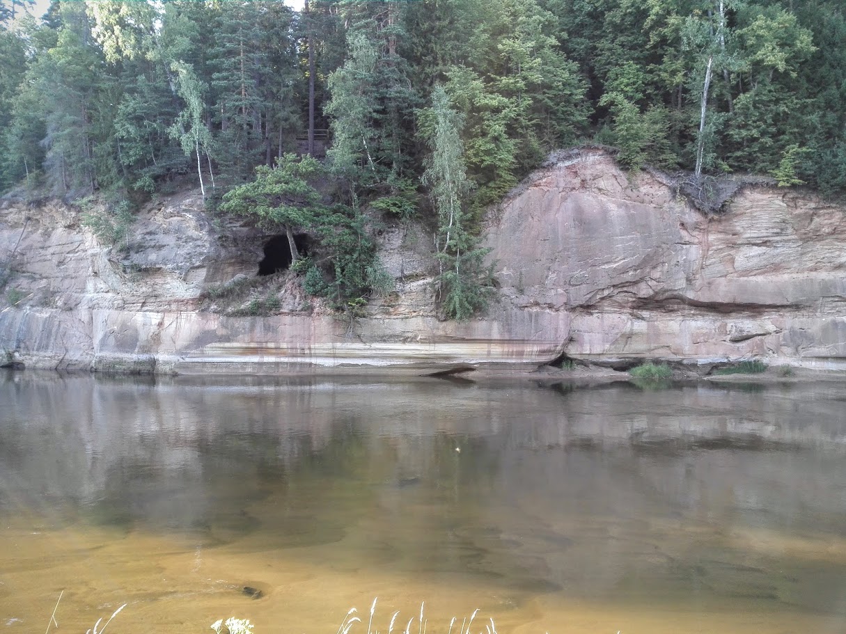
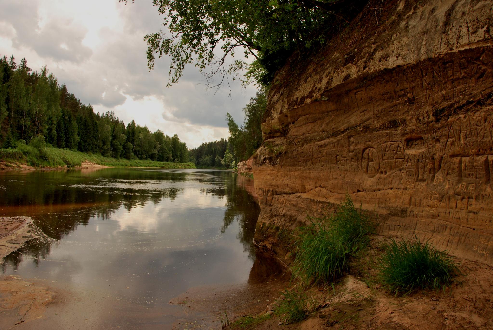
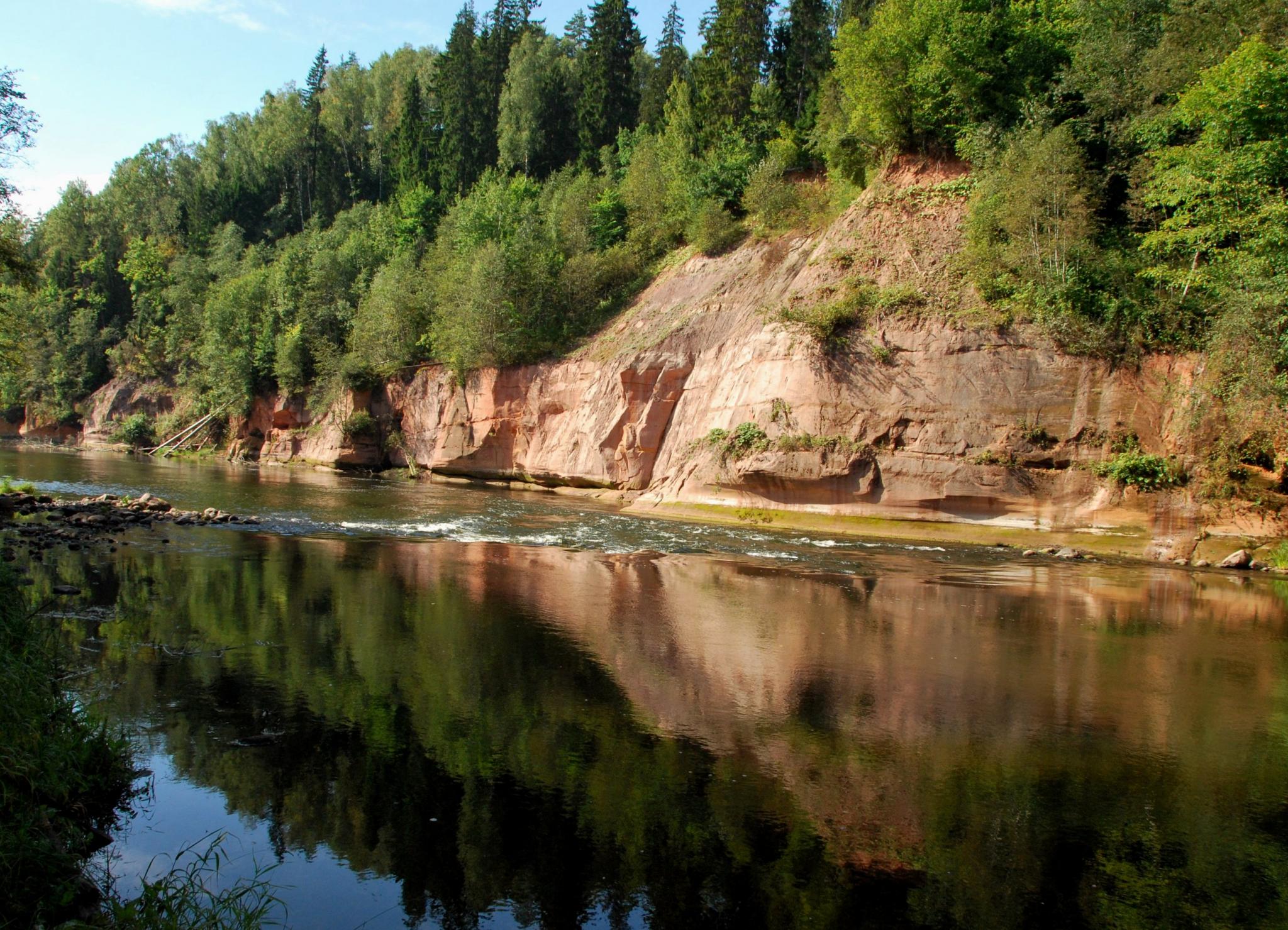
This is the most popular and the most beautiful one day paddling route. Natural attractiveness of Gauja ancient valley is enjoyable both from the paddling boat and by getting out on the shore and looking at Līgavu cave, Kvēpene castle mound and secular oak. Riverbanks are decorated by Briedīši, Vecupe, Edernieku, Leimaņu, Spriņģu rocks and other glamorous outcrops. Majestic Ķūķu cliffs and rapids in several grades will spirit the paddlers. The destination of the route is Līgatne ferry crossing – the only ferry of this type in the Baltic States, which is still running.
One of the most popular two-day leisure routes that runs in the entire length through the Gauja National Park. Riverbanks are decorated with a glamorous rock outcrops and rocks. Briedīši, Vecupe, Edernieku, Leimaņu, Spriņģu, Katrīnas, Gūdu, Launaga rocks and other glamorous outcrops and caves. Majestic Ķūķu cliffs and rapids in several grades will spirit the paddlers. The destination of the route is Līgatne ferry crossing – the only ferry of this type in the Baltic States, which is still running. After Līgatne there begins calmer section. Closer to Sigulda it becomes really calm and almost at every turn will be able to see Turaida castle. We recommend to enjoy natural and cultural objects by getting out of the paddling boats and walking, it is worth to see Kvēpene oak and Līgatne nature trails, as well as to step on the Gleznotāju hill (Painters’ hill) in Sigulda.
The two-day leisure paddling route with enjoyment of attractiveness of the Gauja National Park landscape under accompaniment of calm flow of the river. On the banks of the river - Liepa rock, Sietiniezis rock, Ērgļi cliffs, and a little bit farther from the bank - Grīviņi rock and Līči – Laņģi cliffs.
Several days route through the Gauja National Park, Gauja ancient valley, which includes the most beautiful rocks, rocky outcrops, caves. It is possible to stop and step on Sietiņiezis rock, Ērgļi cliffs or another place with nice views, to walk along Cīrulīši or Līgatne nature trail, and finally to enjoy the natural splendour of the surroundings of Sigulda. For nature lovers it is better to choose the route in spring or autumn when there are less paddlers on the river.
One of the classic paddling routes along the Gauja River. Behind the railway bridge begins exciting river section - Strenči rapids, which continues until Krāčupe estuary. Further the river banks become higher and more picturesque. Behind the Mellupe estuary on the right bank is Sīmanēni Holy Oak, where it is possible to get the strength for further paddling. Closer to Valmiera the river has more sandbanks. The end of the route the in Daliņi is recommended for paddlers who are afraid to go through Kazu rapids in Valmiera, but if you have the skills for getting through rapids and you want to enjoy sharper feelings – surely go futher up to the boat station in Valmiera.
Interesants upes sākumposma maršruts, kur Gauja ir niedrēma aizaugušu posmu, ezeriņu, straujteču un aizsprostu uzpludinājumu virkne. Maršrutu labāk izvēleties pavasarī, kad augstāks ūdens līmenis.Pie Lodes ir svarīgi iekāpt Gaujā pie pareizā tilta – īstais ir pie Stupēnu ezera sākuma.Straujajos posmos jārēķinās ar nebraucamiem šķēršļiem.
Up to Vireši on the banks of the river can be seen dolomite outcrops. Further the river bed becomes sandy, it flows through bushy meadows. At this section Gauja in length of 23 km is border river of Latvia – Estonia, banks are sparsely populated.
The longest paddling route in Latvia where you can enjoy the Gauja starting from a small river the banks of which in summers are overgrown and which is passable with difficulties by the mighty river, which flows into the Gulf of Riga. The river can be divided into 3 sections: section of HPPs cascade, in Popular section and in Upper course section. Section of HPPs cascade is 115.8 km long and it stretches from Lode to Lejasciems (V 415 road) bridge. The Popular section is 252.3 km long and it is from Lejasciems to Sigulda, but Lower course section is 56.1 km long and it runs from Sigulda to its estuary in the Gulf of Riga.
 Lode Manor
 Grocery store "Lats"
 Resting place
Nēķens Manor
Taurene local history exhibition
Resting place
Nēķens Manor
Taurene local history exhibition
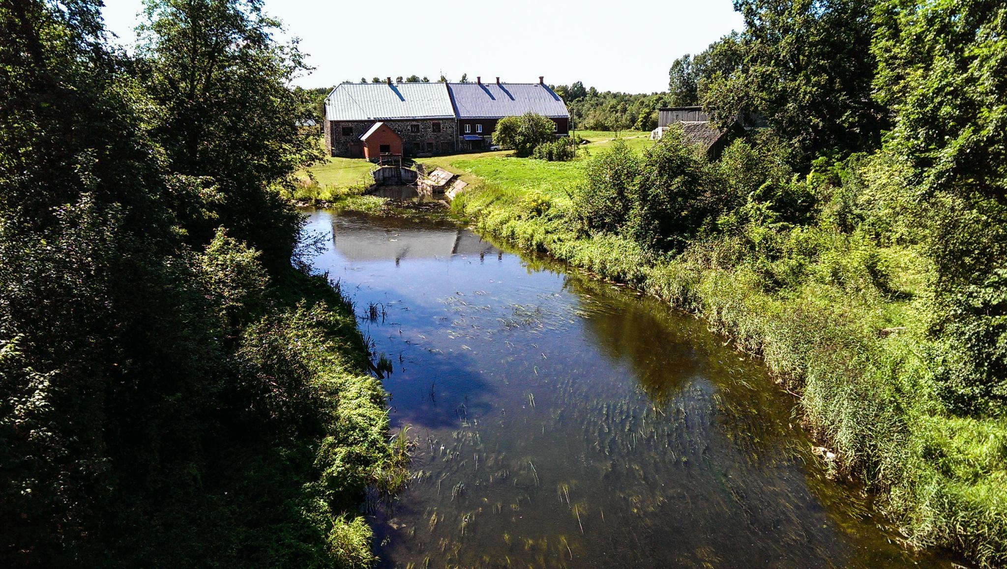
 Nēķens watermill
 Avotnieki
Dzestrene
Piebalga Artwork Repository
Zoseni HES
Ilzēni HES
Jaunķūģi
Avotnieki
Dzestrene
Piebalga Artwork Repository
Zoseni HES
Ilzēni HES
Jaunķūģi
 Vanagkalns
Vecstrupiņi
Vanagkalns
Vecstrupiņi
 Pūliņi
Jaunpiebalga Local History Museum
St. Thomas Evangelical Lutheran Church of Jaunpiebalga
Inn Building of Jaunpiebalga Manor
Jaunpiebalga old watremill dam
Jaunpiebalga Manor
Exebition hall "Velves"
Kastaņi
Gaujas Bedumi
Kalna pakalnieši
Mīlmaņi
Vecpāpani
Varini HES
Rutkaviņu springs
Gauja HES
Candle museum
Lācītes
Lacites HES
Siltie
Velēna Church
Pilskalna HES
Sinole Manor and Water mill
Paideru HES
Kemeri Seravots (spring)
The historical and cultural heritage center of Lejasciems
Lejasciems Secondary Boarding School
Satekas
Līve village
Tirziņa estuary
Sikšņi connection
Pūliņi
Jaunpiebalga Local History Museum
St. Thomas Evangelical Lutheran Church of Jaunpiebalga
Inn Building of Jaunpiebalga Manor
Jaunpiebalga old watremill dam
Jaunpiebalga Manor
Exebition hall "Velves"
Kastaņi
Gaujas Bedumi
Kalna pakalnieši
Mīlmaņi
Vecpāpani
Varini HES
Rutkaviņu springs
Gauja HES
Candle museum
Lācītes
Lacites HES
Siltie
Velēna Church
Pilskalna HES
Sinole Manor and Water mill
Paideru HES
Kemeri Seravots (spring)
The historical and cultural heritage center of Lejasciems
Lejasciems Secondary Boarding School
Satekas
Līve village
Tirziņa estuary
Sikšņi connection
 Sikšņi rapids and Sikšņi dolomite outcrop
Viesturi
Sikšņi rapids and Sikšņi dolomite outcrop
Viesturi
 Rope bridge
Vidaga open-air stage
Vidaga larch alley
Vidaga Sikšņi Elementary School
Vizla arc bridge
Vizla Nature trail
Žākļu secular stone
Liepavoti
Lejasbindi precipice
Luikas
Zemesziediņi
Randati cliffs and trail
Vireši crab tree
Rope bridge
Vidaga open-air stage
Vidaga larch alley
Vidaga Sikšņi Elementary School
Vizla arc bridge
Vizla Nature trail
Žākļu secular stone
Liepavoti
Lejasbindi precipice
Luikas
Zemesziediņi
Randati cliffs and trail
Vireši crab tree
 Laivu nomu "ReLaivas"
 Camping „Zvejnieki”
Vireši
Žagatu cliffs
Melderītis
Museum of composer J.Vītols "Anniņas"
Gaujiena Elementary Boarding School
Gaujiena
Gaujiena Manor
Egļukalns open-air stage
Zvārtava Lake
Zvārtava Castle
Mežrozītes
Resting place Kaģuciemā
Tellingumäe campfire spot, observation tower, bike trails
Koiva-Mustjõe landscape protection area
Ala -Konnu
Korgeperve
Resting place
Kaldavere Tourism Farm
Lēģerīši
Laanemetsa Church
Laanemetsa Manor
Tilikas
Resting place
Sightseeing tower
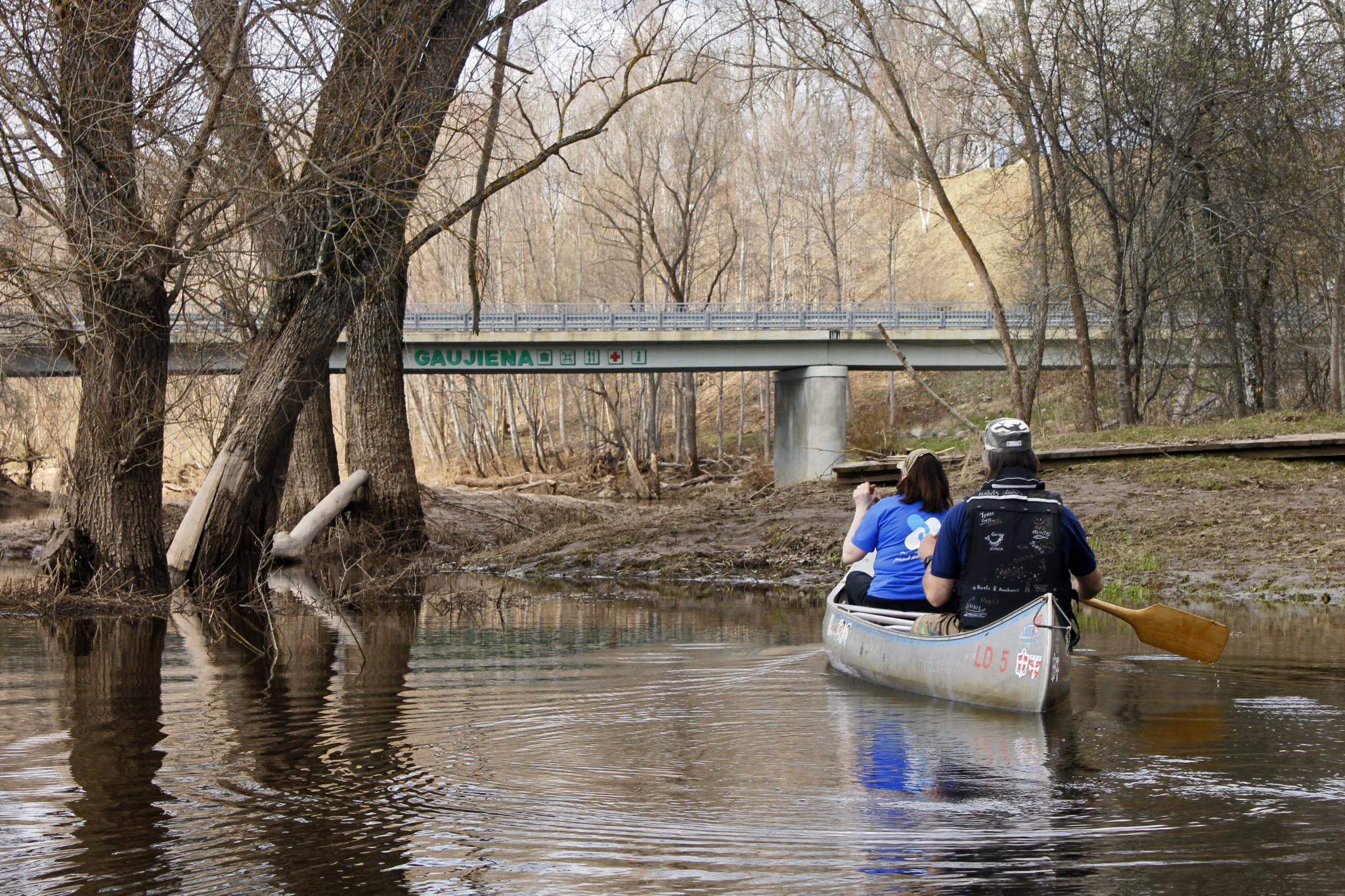
Aņņi
Vecupe
Gauja flood-land meadows
Krastiņi
Resting place
Mežvidi
Zīle Nature trail
Vekši Nature trail
Plave for tying rafts
Spicrāmis
Etnographic farm “Ielīcas”
Iežulejas
Kankarīši rock
Resting place
Resting place
Rāmnieki sandstone outcrop
Resting place
Resting place
Vācu stiga
Resting place
Strenči bridge
Resting place
Resting place
Strenči Nature trail
Strenči
Resting place
Strenču rapids
Krāči
Cīruļi steep bank
Cīruļi
Mellupe masonry bridge
Sīmanēni Holy Oak
Jaunarāji
Baiļi
Daliņi
Gauja Steep banks Park of senses
Vanšu bridge
Kazu rapids
Valterkalniņš
Valmiera music school
Valmiera Museum
Valmiera St. Simon`s church
Valmiera bridge
Inscription “Valmiera”
Vidzeme University of Applied Sciences and Valmiera Integrated Library
Narrow-gauge railway bridge
Gaujaspriedes
Gauja National Park
Straupnieki
Peka hill
Sapa
Lejas ozoli
Liepa rock
Sietiņiezis rock
Grīviņi
Grīviņi cliffs
Caunītes
Līči - Laņģi cliffs
Collection of chairs and ceramic workshop “Lejas Bregži”
Rauna
Railway bridge across the Rauna River
Kazu rock
Jāņrāmis
Ramātu cliffs
Priedulājs
Ērgļu cliffs
Lenči
Lenčupe
Red cliffs
Family house of sculptors Jansons “Siļķes”
Camping ,,Cēsu plosti un laivas''
Kempings "Jeņču laivas"
Cēsis
Žagarkalns
Cīrulīši Nature Trail
Līgavas cave (Bride’s cave).
Ozolkalns
Supervāvere
Kvēpene
Rakši
Kvēpene castle mound and Kvēpene oak
Briedīši rock
Briedīši
Edernieku rock
Ķūķi rock
Līņu cliffs
Enkura rock
Rehabilitation centre “Līgatne”
Soviet Secret Bunker
Skaļupe
Spriņģu rock
Canoe camp site “Makars”
Camping „Zvejnieki”
Vireši
Žagatu cliffs
Melderītis
Museum of composer J.Vītols "Anniņas"
Gaujiena Elementary Boarding School
Gaujiena
Gaujiena Manor
Egļukalns open-air stage
Zvārtava Lake
Zvārtava Castle
Mežrozītes
Resting place Kaģuciemā
Tellingumäe campfire spot, observation tower, bike trails
Koiva-Mustjõe landscape protection area
Ala -Konnu
Korgeperve
Resting place
Kaldavere Tourism Farm
Lēģerīši
Laanemetsa Church
Laanemetsa Manor
Tilikas
Resting place
Sightseeing tower
Aņņi
Vecupe
Gauja flood-land meadows
Krastiņi
Resting place
Mežvidi
Zīle Nature trail
Vekši Nature trail
Plave for tying rafts
Spicrāmis
Etnographic farm “Ielīcas”
Iežulejas
Kankarīši rock
Resting place
Resting place
Rāmnieki sandstone outcrop
Resting place
Resting place
Vācu stiga
Resting place
Strenči bridge
Resting place
Resting place
Strenči Nature trail
Strenči
Resting place
Strenču rapids
Krāči
Cīruļi steep bank
Cīruļi
Mellupe masonry bridge
Sīmanēni Holy Oak
Jaunarāji
Baiļi
Daliņi
Gauja Steep banks Park of senses
Vanšu bridge
Kazu rapids
Valterkalniņš
Valmiera music school
Valmiera Museum
Valmiera St. Simon`s church
Valmiera bridge
Inscription “Valmiera”
Vidzeme University of Applied Sciences and Valmiera Integrated Library
Narrow-gauge railway bridge
Gaujaspriedes
Gauja National Park
Straupnieki
Peka hill
Sapa
Lejas ozoli
Liepa rock
Sietiņiezis rock
Grīviņi
Grīviņi cliffs
Caunītes
Līči - Laņģi cliffs
Collection of chairs and ceramic workshop “Lejas Bregži”
Rauna
Railway bridge across the Rauna River
Kazu rock
Jāņrāmis
Ramātu cliffs
Priedulājs
Ērgļu cliffs
Lenči
Lenčupe
Red cliffs
Family house of sculptors Jansons “Siļķes”
Camping ,,Cēsu plosti un laivas''
Kempings "Jeņču laivas"
Cēsis
Žagarkalns
Cīrulīši Nature Trail
Līgavas cave (Bride’s cave).
Ozolkalns
Supervāvere
Kvēpene
Rakši
Kvēpene castle mound and Kvēpene oak
Briedīši rock
Briedīši
Edernieku rock
Ķūķi rock
Līņu cliffs
Enkura rock
Rehabilitation centre “Līgatne”
Soviet Secret Bunker
Skaļupe
Spriņģu rock
Canoe camp site “Makars”
 Līgatne
Guest house "Zaļais Lācis"
Līgatne ferry crossing
National fishing occupation museum
Jumpravu rock
Katrīna
Katrīnas rock
Līgatne Nature Trail
Gūdu cliffs
Paslavas
Launaga rock
Elpu rock
Brasla
Camping Jaunzāģeri
Resting place “Bērzi”
Guest house "Mošķu pirts"
Left bank tributary Dauda
Left bank tributary Vējupīte
Resting place “Vējupīte”
Kempings "Dainas"
Glemping “Klaukas”
Resting place “Sigulda”
Resting place
Sigulda bridge (P8)
Laivu un SUP noma "River Adventures"
Boat and SUP rental “Mučas”
Boat and SUP rental “Čiekurlaivas”
Camping Sigulda beach
Camping "Siguldas pludmale"
RD Active
Resting place
Resting place
Krimulda Devil's Cave
Bridge
Left bank tributary Lorupe
Right bank tributary Runtiņš
Big (Devil's) Stone
Resting place
Resting place
Katlapu rock
Resting place
Left bank tributary Egļupe
Resting place „Zābakkalns”
Guest house "Zvīguļi"
Recreation Center "Rāmkalni"
Murjāņi bridge (A3)
Guest house "Rūķīši"
Inčukalns Devil's Cave
Recreation centre "Zušu pļava"
"Citi Krasti" Eco Spa Residence
Artist Garden of Anna Ludiņa
Resting place
Resting place at Āņi
"Gaujmale" guest house
Resting place at Iļķene
Guest house “Mazpipari”
Leiputrija
Laivot Gauja
Left bank the Gauja - Daugava channel
Resting place next to bridge of Gauja
Ādaži bridge
Burusports SUP rental
Grocery store "TOP"
Guest house "Abzaļi"
"Zvaniņu ceļš"
Guest house "Laba pirts"
Bridge (A1)
Pārtikas veikals "Aibe"
Ethnographic holiday lodge Gungas
Resting place
Brīvdienu mājas "GaujaUpe"
Railway, pedestrian bridges
Resting place
Boards You
Līgatne
Guest house "Zaļais Lācis"
Līgatne ferry crossing
National fishing occupation museum
Jumpravu rock
Katrīna
Katrīnas rock
Līgatne Nature Trail
Gūdu cliffs
Paslavas
Launaga rock
Elpu rock
Brasla
Camping Jaunzāģeri
Resting place “Bērzi”
Guest house "Mošķu pirts"
Left bank tributary Dauda
Left bank tributary Vējupīte
Resting place “Vējupīte”
Kempings "Dainas"
Glemping “Klaukas”
Resting place “Sigulda”
Resting place
Sigulda bridge (P8)
Laivu un SUP noma "River Adventures"
Boat and SUP rental “Mučas”
Boat and SUP rental “Čiekurlaivas”
Camping Sigulda beach
Camping "Siguldas pludmale"
RD Active
Resting place
Resting place
Krimulda Devil's Cave
Bridge
Left bank tributary Lorupe
Right bank tributary Runtiņš
Big (Devil's) Stone
Resting place
Resting place
Katlapu rock
Resting place
Left bank tributary Egļupe
Resting place „Zābakkalns”
Guest house "Zvīguļi"
Recreation Center "Rāmkalni"
Murjāņi bridge (A3)
Guest house "Rūķīši"
Inčukalns Devil's Cave
Recreation centre "Zušu pļava"
"Citi Krasti" Eco Spa Residence
Artist Garden of Anna Ludiņa
Resting place
Resting place at Āņi
"Gaujmale" guest house
Resting place at Iļķene
Guest house “Mazpipari”
Leiputrija
Laivot Gauja
Left bank the Gauja - Daugava channel
Resting place next to bridge of Gauja
Ādaži bridge
Burusports SUP rental
Grocery store "TOP"
Guest house "Abzaļi"
"Zvaniņu ceļš"
Guest house "Laba pirts"
Bridge (A1)
Pārtikas veikals "Aibe"
Ethnographic holiday lodge Gungas
Resting place
Brīvdienu mājas "GaujaUpe"
Railway, pedestrian bridges
Resting place
Boards You
 Piedzīvojums – koka kuteris “Sandra”
Resting place
Piedzīvojums – koka kuteris “Sandra”
Resting place
 Maza upe
Carnikava Local History Centre
The nature park "Piejura"
Gauja estuary in the sea
Maza upe
Carnikava Local History Centre
The nature park "Piejura"
Gauja estuary in the sea


''Jaunjūgas-3'', Amata, Drabešu pag., Amatas nov., LV-4101
(+371) 29585850
(+371) 26349111


"Jaunšķēpeles Dzirnavas", Līgatnes pag., Līgatnes novads, LV-4108
(+371) 26466750
(+371) 26300124


Laivu iela 2, Carnikava, Carnikavas pagasts, Ādažu novads, LV-2163
(+371) 26222212


Ezremalas iela 45a, Alūksne
(+371) 20377881


“Stirniņas”, Iļķene, Ādažu novads, Rīgas rajons, Latvija; LV-2164
(+371) 26405596
(+371) 29267705


Ropažu novads, Stopiņu pagasts, Līči, Poldera iela 10, “Sidrabozoli”
(+371) 28342558
(+371) 29247472


“Ziedoņi”, Jaunpiebalgas pagasts, Jaunpiebalgas novads, LV-4125
(+371) 25902905
(+371) 26567616
(+372) 511 9117
(+372) 514 5430

