


Abava route download for mobile devices (android/iphone)
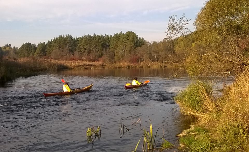
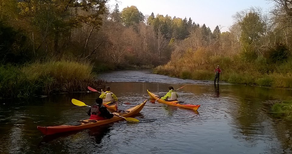
Abava is reasonably considered a classic of paddling rivers of Latvia. In summer season the river is calm throughout its paddling route, without insurmountable barriers or rapids, therefore great for everyone - families with children and those who haven't been in a boat before. Only 92 of 129 km from the river are suitable for paddling.
The Abava river is usually divided in two parts – the "civilized" one and the "wild" one. Civilized part is considered to be from Kandava (B) to Renda (G) (49, 5 km), but the wild one – from Renda (G) to the mouth of the river Venta and L. Nabes lake (42km).
When paddling into the Venta river follow your boat rental company's recommendations. Most probobly you will need to continue along the Venta (6,8km) and Nabe-channel (1.5 km) to the Big Nabe lake camping site "Nabīte '( H ) or across the lake (900 m) to the Southern bank (I).
The most popular routes
Kandava - Sabile - 23.5 km
Sabile - Renda - 26 km
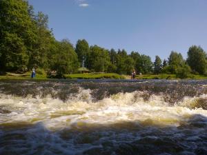
Waterfall of the Abava river - Renda - 20.6 km
Renda - Venta river - Nabe lake 42 km
- You can paddle on the Abava river with all kinds of boats;
- "River collectors" can extend the routes by getting in boats by the Vaski bridge (motorway P104 Tukums - Jaunpils). Here you have to be ready for shallow and impossible places.
- In routes from Kandava to Renda, getting from the start and to the finish points can be scheduled by public transportation.
- When you paddle, you can find directions on trees on river banks and other markers that show you the distance to Renda and further to Venta.
- Respect the private property and protect the nature, leave the camp sites clean and tidy, take the garbage with you! The Abava river between Kandava and up to the mouth of the Venta river flows through Abava nature park area.
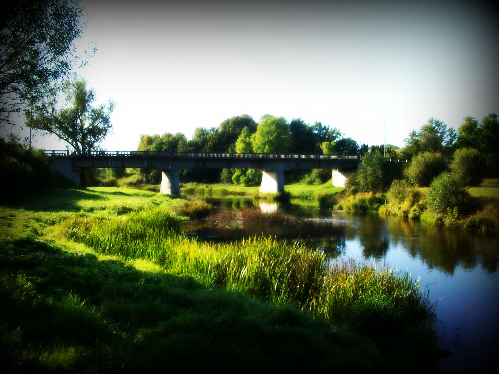
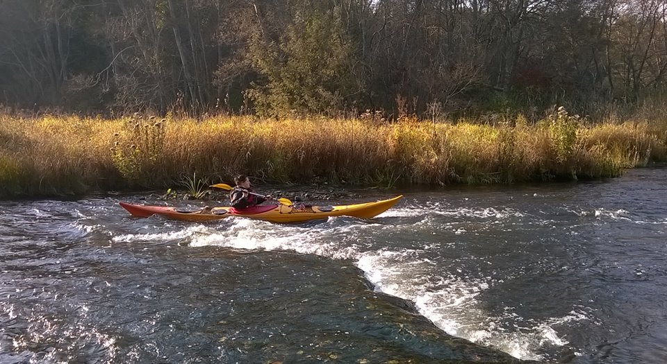
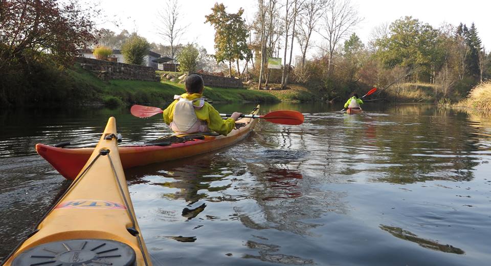
Near Kandava (B) the river is very winding and at its first kilometres you may think why did you even come here? And just at that moment the boat is rapidly tolerated under unfinished bridge and shoots through the first Abava overfall. Shores of Abava here resembles a Tuscan landscape with grape fields on the slopes.
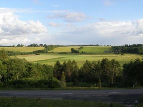
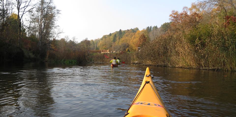
Further on the paddling becomes much more interesting, as the river begins to flow through a wide valley and the landscape around it becomes more and more picturesque. In the stretch till Sabile (D), there are many well-appointed reasting areas and tourist attractions.
Sabile (D) is definitely worth a stop to stroll through the small town or buy some treats.
After Sabile (D), the Abava river becomes much calmer and slowly flows through a forest. Shores become steeper and first cliffs (approx. 15m high) start to appear. The slow flow of 6 km is stopped by Waterfall on the Abava river (Abavas Rumba) (E) - a meter high waterfall that has stretched across the width of the river.
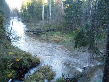
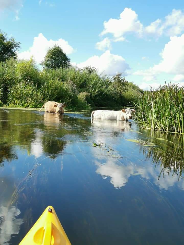
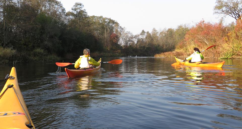
After the waterfall, the river's speed increases and you start to feel a bit of wilderness. Overfalls mixes with each other and nature overtakes the river. Ducks, beavers, deer's, herons, storks and hawks become nothing extraordinary. In some parts river passes sand dunes.
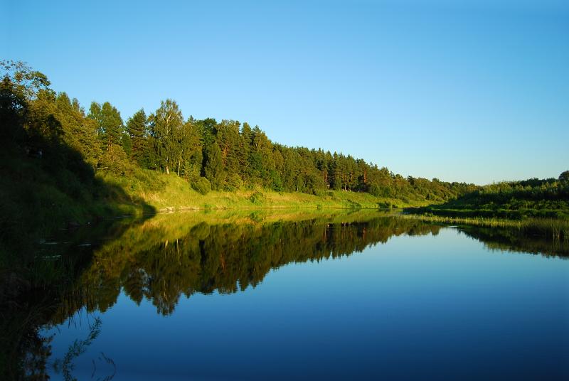
Around Renda (G) the Abava river returns to civilization. Already 6 km before the bridge of Renda the flow of the river becomes really calm and some houses located on the shores start to appear. In Renda the "civilized" part ends and the "wild" one starts. Paddlers do not have one opinion if the most beautiful stretch of the Abava river is from Kandava to Renda or from Renda to the mouth of the Venta river.
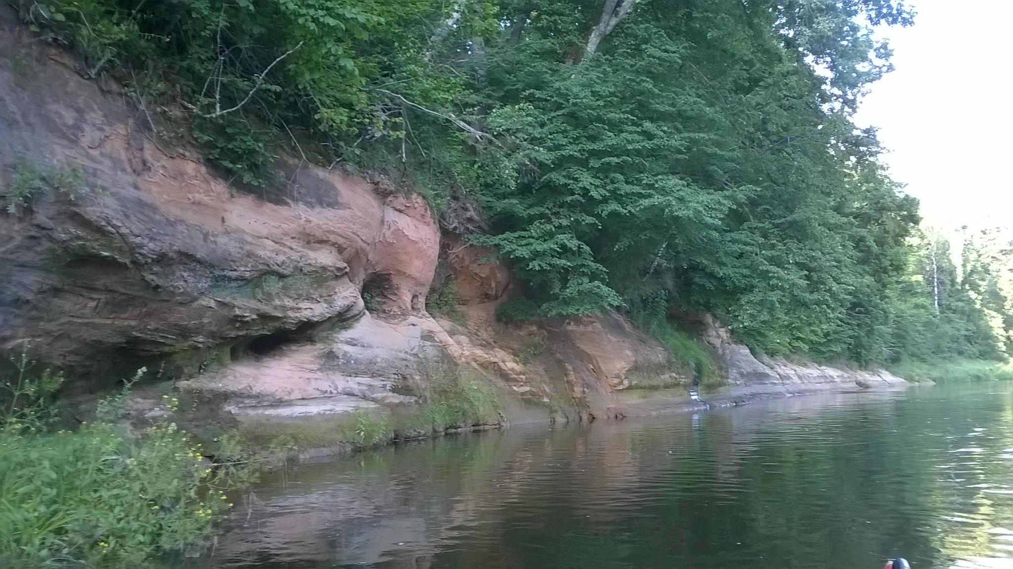
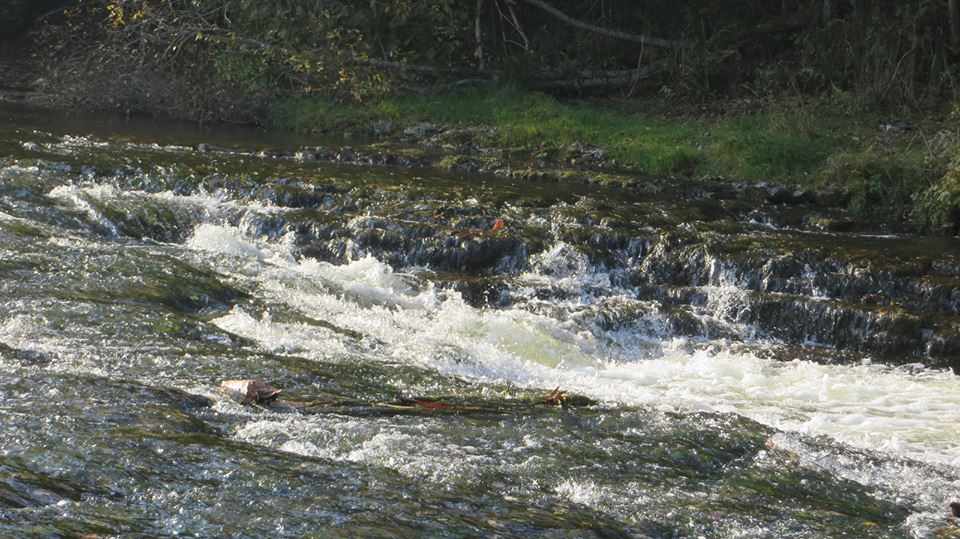
Slow flow continues 5 km after Renda (G), until it is stopped by the first rapids. Moreover, the scenery changes completely. Shores that were overgrown with shrubs and deciduous trees are replaced by coniferous trees, river-bed becomes stony, but the water becomes clear. Below Renda to where Abava flows into the Venta river there are almost no buildings. However, there are many sites where you can do the camping, overfalls are being mixed with slower stretches, the banks of larger and smaller sandstone and dolomite cliffs follow one after another, some of them are overgrown and not as easily visible, watch closely! If you stay calm, you can meet many wild animals.
Approaching Venta, the Abava river becomes narrower, deeper and swifter. Approximately 30m high cliff Galmicu is a good landmark 5 km before the mouth of the Venta river. Those who just remembered that they have not managed to take a picture of anything, can still have time to take beautiful photos.
When paddling into the Venta river follow your boat rental company's recommendations, and either stop paddling at the place where the Abava flows into the Venta river or continue along the path of the Venta (6,8km) and Nabe-channel (1.5 km) to the Big Nabe lake camping site "Nabīte" (H) or across the lake (900 m) to the Southern bank (I).
Near Kandava (B) the river is very winding and at its first kilometres you may think why did you even come here? And just at that moment the boat is rapidly tolerated under unfinished bridge and shoots through the first Abava overfall. Shores of Abava here resembles a Tuscan landscape with grape fields on the slopes.
Further on the paddling becomes much more interesting, as the river begins to flow through a wide valley and the landscape around it becomes more and more picturesque. In the stretch till Sabile (D), there are many well-appointed reasting areas and tourist attractions.
Sabile (D) is definitely worth a stop to stroll through the small town or buy some treats.
After Sabile (D), the Abava river becomes much calmer and slowly flows through a forest. Shores become steeper and first cliffs (approx. 15m high) start to appear. The slow flow of 6 km is stopped by Waterfall on the Abava river (Abavas Rumba) (E) - a meter high waterfall that has stretched across the width of the river.
After the waterfall, the river's speed increases and you start to feel a bit of wilderness. Overfalls mixes with each other and nature overtakes the river. Ducks, beavers, deer's, herons, storks and hawks become nothing extraordinary. In some parts river passes sand dunes.
Around Renda (G) the Abava river returns to civilization. Already 6 km before the bridge of Renda the flow of the river becomes really calm and some houses located on the shores start to appear. In Renda the "civilized" part ends and the "wild" one starts. Paddlers do not have one opinion if the most beautiful stretch of the Abava river is from Kandava to Renda or from Renda to the mouth of the Venta river.
Slow flow continues 5 km after Renda (G), until it is stopped by the first rapids. Moreover, the scenery changes completely. Shores that were overgrown with shrubs and deciduous trees are replaced by coniferous trees, river-bed becomes stony, but the water becomes clear. Below Renda to where Abava flows into the Venta river there are almost no buildings. However, there are many sites where you can do the camping, overfalls are being mixed with slower stretches, the banks of larger and smaller sandstone and dolomite cliffs follow one after another, some of them are overgrown and not as easily visible, watch closely! If you stay calm, you can meet many wild animals.
Approaching Venta, the Abava river becomes narrower, deeper and swifter. Approximately 30m high cliff Galmicu is a good landmark 5 km before the mouth of the Venta river. Those who just remembered that they have not managed to take a picture of anything, can still have time to take beautiful photos.
When paddling into the Venta river follow your boat rental company's recommendations, and either stop paddling at the place where the Abava flows into the Venta river or continue along the path of the Venta (6,8km) and Nabe-channel (1.5 km) to the Big Nabe lake camping site "Nabīte" (H) or across the lake (900 m) to the Southern bank (I).
After the waterfall, the river's speed increases and you start to feel a bit of wilderness. Overfalls mixes with each other and nature overtakes the river. Ducks, beavers, deer's, herons, storks and hawks become nothing extraordinary. In some parts river passes sand dunes.
Around Renda (G) the Abava river returns to civilization. Already 6 km before the bridge of Renda the flow of the river becomes really calm and some houses located on the shores start to appear. In Renda the "civilized" part ends and the "wild" one starts. Paddlers do not have one opinion if the most beautiful stretch of the Abava river is from Kandava to Renda or from Renda to the mouth of the Venta river.
Near Kandava (B) the river is very winding and at its first kilometres you may think why did you even come here? And just at that moment the boat is rapidly tolerated under unfinished bridge and shoots through the first Abava overfall. Shores of Abava here resembles a Tuscan landscape with grape fields on the slopes.
Further on the paddling becomes much more interesting, as the river begins to flow through a wide valley and the landscape around it becomes more and more picturesque. In the stretch till Sabile (D), there are many well-appointed reasting areas and tourist attractions.
Sabile (D) is definitely worth a stop to stroll through the small town or buy some treats.
After Sabile (D), the Abava river becomes much calmer and slowly flows through a forest. Shores become steeper and first cliffs (approx. 15m high) start to appear. The slow flow of 6 km is stopped by Waterfall on the Abava river (Abavas Rumba) (E) - a meter high waterfall that has stretched across the width of the river.
After the waterfall, the river's speed increases and you start to feel a bit of wilderness. Overfalls mixes with each other and nature overtakes the river. Ducks, beavers, deer's, herons, storks and hawks become nothing extraordinary. In some parts river passes sand dunes.
Around Renda (G) the Abava river returns to civilization. Already 6 km before the bridge of Renda the flow of the river becomes really calm and some houses located on the shores start to appear. In Renda the "civilized" part ends and the "wild" one starts. Paddlers do not have one opinion if the most beautiful stretch of the Abava river is from Kandava to Renda or from Renda to the mouth of the Venta river.
The Abava stretch is known as the wild one. The river flows through the mostly deserted territories, only when approaching Venta, houses appear
Slow flow continues 5 km after Renda (G), until it is stopped by the first rapids. Moreover, the scenery changes completely. Shores that were overgrown with shrubs and deciduous trees are replaced by coniferous trees, river-bed becomes stony, but the water becomes clear. Below Renda to where Abava flows into the Venta river there are almost no buildings. However, there are many sites where you can do the camping, overfalls are being mixed with slower stretches, the banks of larger and smaller sandstone and dolomite cliffs follow one after another, some of them are overgrown and not as easily visible, watch closely! If you stay calm, you can meet many wild animals.
Approaching Venta, the Abava river becomes narrower, deeper and swifter. Approximately 30m high cliff Galmicu is a good landmark 5 km before the mouth of the Venta river. Those who just remembered that they have not managed to take a picture of anything, can still have time to take beautiful photos.
When paddling into the Venta river follow your boat rental company's recommendations, and either stop paddling at the place where the Abava flows into the Venta river or continue along the path of the Venta (6,8km) and Nabe-channel (1.5 km) to the Big Nabe lake camping site "Nabīte '( H) or across the lake (900 m) to the Southern bank (I).
Sabile (D) is definitely worth a stop to stroll through the small town or buy some treats.
After Sabile (D), the Abava river becomes much calmer and slowly flows through a forest. Shores become steeper and first cliffs (approx. 15m high) start to appear. The slow flow of 6 km is stopped by Waterfall on the Abava river (Abavas Rumba) (E) - a meter high waterfall that has stretched across the width of the river.
After the waterfall, the river's speed increases and you start to feel a bit of wilderness. Overfalls mixes with each other and nature overtakes the river. Ducks, beavers, deer's, herons, storks and hawks become nothing extraordinary. In some parts river passes sand dunes.
Around Renda (G) the Abava river returns to civilization. Already 6 km before the bridge of Renda the flow of the river becomes really calm and some houses located on the shores start to appear. In Renda the "civilized" part ends and the "wild" one starts. Paddlers do not have one opinion if the most beautiful stretch of the Abava river is from Kandava to Renda or from Renda to the mouth of the Venta river.
Typical one day route to explore part of Abava river, fast rapinds come one after another, and there is no time to get bored. Closer to Renda, river is calmer. Already 6 km before the bridge of Renda the flow of the river becomes really calm and some houses located on the shores start to appear.
Easy one day tour down Abava river.
Near Kandava (B) the river is very winding and at its first kilometres you may think why did you even come here? And just at that moment the boat is rapidly tolerated under unfinished bridge and shoots through the first Abava overfall. Shores of Abava here resembles a Tuscan landscape with grape fields on the slopes.
Further on the paddling becomes much more interesting, as the river begins to flow through a wide valley and the landscape around it becomes more and more picturesque.
 Šokolādes muzejs
 Gājēju tiltiņš
 Laipas
 Sumbrs
 Teikas
Pils
Akmens mūra tilts Kandavā
Kandavas tehnikuma dienesta viesnīca
Iekšlietu ministrijas atpūtas bāze
Nāriņa - 3
Dižpriedes-1
Kandava
Kandavas sporta halles viesnīca
Čužu purva taka
Teikas
Pils
Akmens mūra tilts Kandavā
Kandavas tehnikuma dienesta viesnīca
Iekšlietu ministrijas atpūtas bāze
Nāriņa - 3
Dižpriedes-1
Kandava
Kandavas sporta halles viesnīca
Čužu purva taka
 Vecie Ozolāji
Zvejnieku tilts
Sviļu priedes
Velnakmens un Velnala
Kārkli
Plosti
Plostkrogs
Plostkrogs
Abavlīči
Lejaslangsēde
Vītiņi
Ģimenes vīna darītava "Abavas"
Open-air Art Museum at Pedvale
Trosu ceļš pāri Abavai
Zviedru cepure
Drubazas
Vecie Ozolāji
Zvejnieku tilts
Sviļu priedes
Velnakmens un Velnala
Kārkli
Plosti
Plostkrogs
Plostkrogs
Abavlīči
Lejaslangsēde
Vītiņi
Ģimenes vīna darītava "Abavas"
Open-air Art Museum at Pedvale
Trosu ceļš pāri Abavai
Zviedru cepure
Drubazas
 Hostel Hospital
Sabiles mājas vīnu degustācija
Rumbules
Sabiles sidra darītava
Koka rotaļlietu muzejs
Sabiles tūrisma informācijas centrs
Sabiles Vīna kalns
Sabiles pilskalns
Mūsdienu mākslas un kultūras mantojuma centrs “Sinagoga”
Rotkaļa darbnīca
Leļļu dārzs
Sabiles evaņģēliski luteriskā baznīca
Mākslas dārzs "Nekurienes vidū"
Abavas Rumba
Sventes dzirnavas
Bļodas
Laupītāju ala
Hostel Hospital
Sabiles mājas vīnu degustācija
Rumbules
Sabiles sidra darītava
Koka rotaļlietu muzejs
Sabiles tūrisma informācijas centrs
Sabiles Vīna kalns
Sabiles pilskalns
Mūsdienu mākslas un kultūras mantojuma centrs “Sinagoga”
Rotkaļa darbnīca
Leļļu dārzs
Sabiles evaņģēliski luteriskā baznīca
Mākslas dārzs "Nekurienes vidū"
Abavas Rumba
Sventes dzirnavas
Bļodas
Laupītāju ala
 Taciņa uz Māras kambariem
Māras kambari
Avoti
Taciņa uz Māras kambariem
Māras kambari
Avoti
 Abavas pagrabiņš
 Shop
Atpūtas vieta
Abavas
Ceļmaļi
Apmetnes vieta
Atpūtas vieta
Apmetnes vieta
Zārdava
Orientieris - 15 km līdz Ventai
Apmetnes vieta
Apmetnes vieta
Apmetnes vieta
Apmetnes vieta
Apmetnes vieta
Atsegumi
Apmetnes vieta
Zilumu ieži
Galmicu klints
Lējēju (Sildruvu) klintis
Muižarāju klintis
Shop
Atpūtas vieta
Abavas
Ceļmaļi
Apmetnes vieta
Atpūtas vieta
Apmetnes vieta
Zārdava
Orientieris - 15 km līdz Ventai
Apmetnes vieta
Apmetnes vieta
Apmetnes vieta
Apmetnes vieta
Apmetnes vieta
Atsegumi
Apmetnes vieta
Zilumu ieži
Galmicu klints
Lējēju (Sildruvu) klintis
Muižarāju klintis


(+371) 26426992


Kurorta iela 10, Kandava
(+371) 29199834


